WGEW
The Walnut Gulch Experimental WatershedWho Operates and Manages this LTAR Site?
The Southwest Watershed Research Center (SWRC) of USDA-ARS manages the 150 km2 Walnut Gulch Experimental Watershed (WGEW) which surrounds the town of Tombstone, Arizona and has been extensively studied since 1953. SWRC does not own the land, which is a mix of Arizona State Land, Bureau of Land Management, and private land, nor does SWRC control land management.
Description
WGEW is one of two USDA-ARS experimental watersheds in the western US for the purpose of understanding watershed processes, the other being the Reynolds Creek Experimental Watershed. The mission of the SWRC is to develop knowledge and technology to conserve water and soil in semi-arid lands. Our goals are to quantify, understand, and model the effects of changing land use, management practices, and weather on the hydrologic cycle, gas exchange cycles, soil erosion processes, and watershed resources in a semi-arid rangeland environment. The SWRC also performs research on the 7600 km2 San Pedro River Basin surrounding WGEW and maintains 8 experimental watersheds on the University of Arizona Santa Rita Experimental Range (SRER), a National Ecological Observatory Network (NEON) core site.
Geography
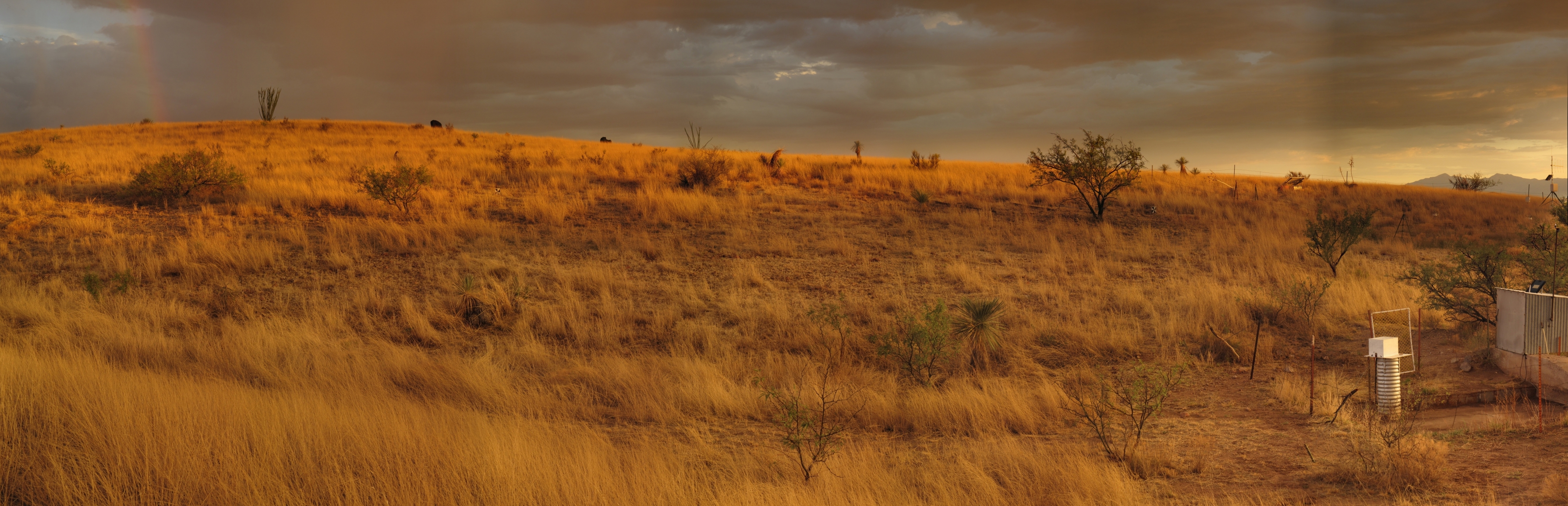
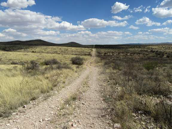
Located in the transition zone between the Sonoran and Chihuahuan deserts (31°430N, 110°410W), the elevation ranges from 1220 to 1950 m. Desert shrubs dominate the lower two thirds of the watershed and desert grasses dominate the upper third, which also includes a small area extending into oak savannah.
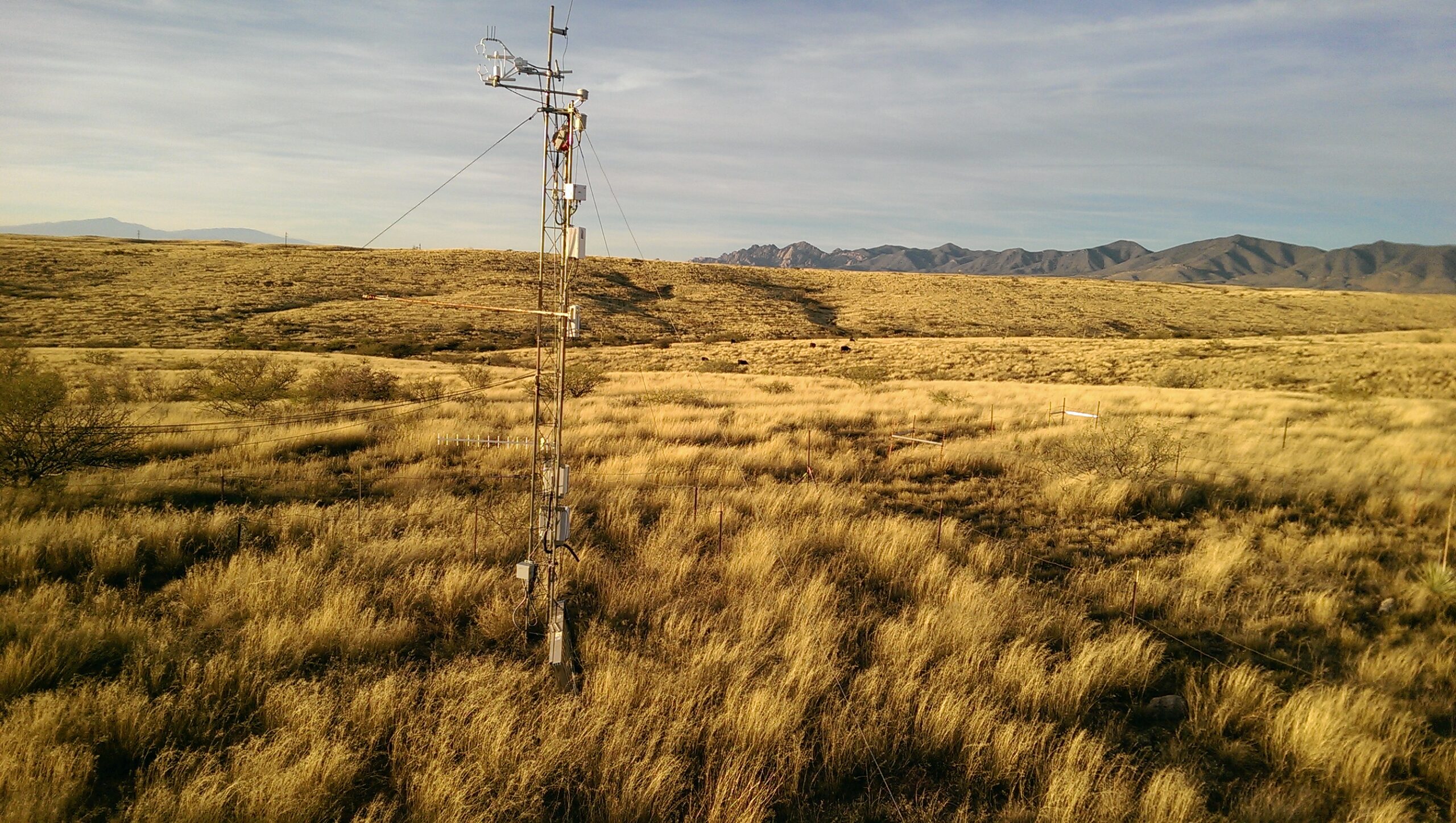
Instrumentation
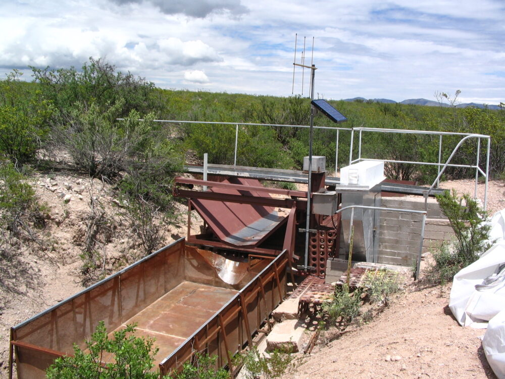
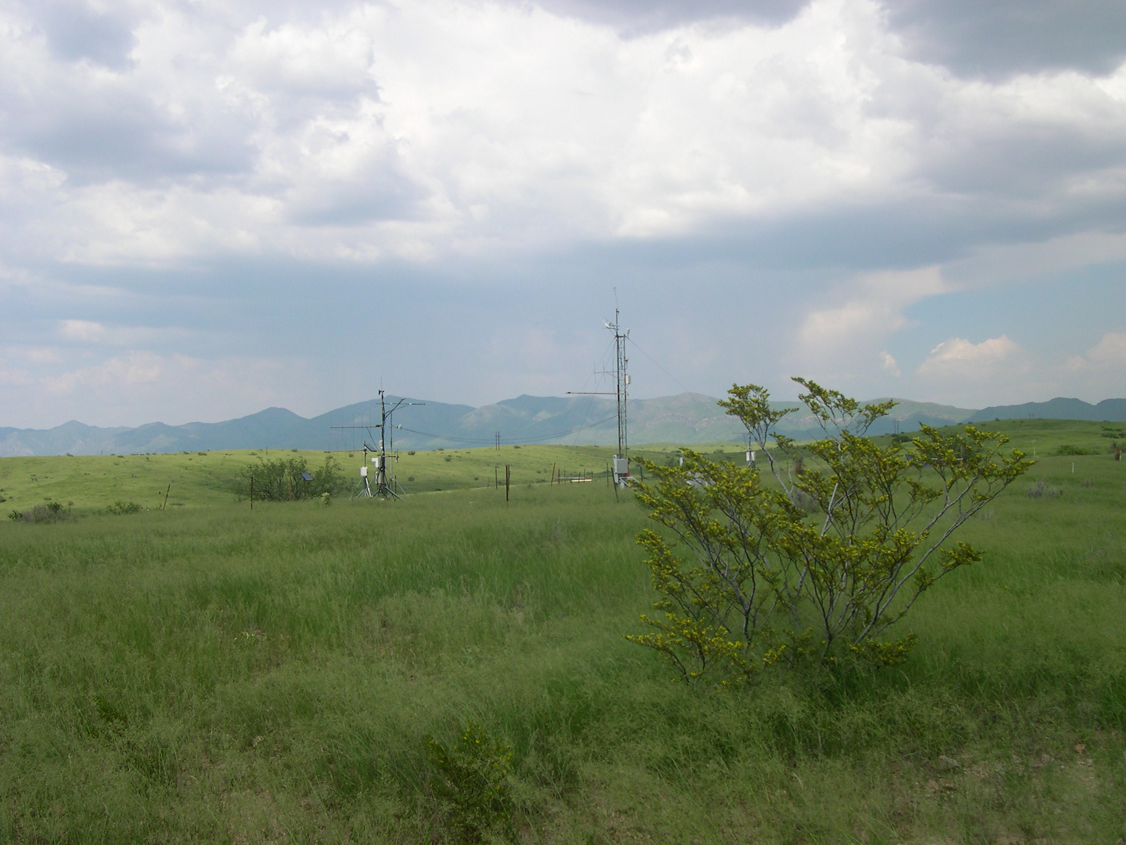
The WGEW is one of the most intensively instrumented semiarid experimental watersheds in the world, with a 10- to 100-year record of abiotic and biotic measurements and photographs. Hydro-meteorological and soil erosion/sedimentation data are collected from numerous instruments on WGEW. Precipitation is measured with a network of 97 weighing-type recording rain gauges. Surface runoff is measured at a range of scales. To isolate the effects rainfall intensity on runoff from soil and vegetation characteristics, runoff is measured at 9 small watersheds (0.002 to 0.06 km2) by structures including a broad-crested V-notch weir, two H-flumes, and six Santa Rita supercritical flow flumes. Channel network processes and rainfall spatial variability are studied using 11 nested watersheds instrumented with large flumes. Sediment from the small watersheds is sampled either with automatic pump samplers or with total-load automatic traversing slot samplers. Sediment accumulation in 7 stock ponds is measured through periodic topographic surveys of the ground surface of each stock pond. Meteorological, soil moisture and temperature, and energy/water/carbon dioxide flux (eddy covariance) measurements are made at two vegetation/soil complexes. The Lucky Hills intensive monitoring site is a shrubland and Kendall is a grassland, although there are signs of shrubs invading. The SWRC has made a concerted effort to make observations, knowledge, and data from its outdoor laboratories readily available via the internet (https://www.tucson.ars.ag.gov/dap).
Classification System
Farm Resource Regions: Fruitful Rim
Major Farm Region: Mountain Region
Hydrologic Unit Codes (HUC-2): Region 15 (Lower Colorado)
National Ecological Observatory Network (NEON): Domain D14 (Desert Southwest)
NRCS Major Land: Common Resource Area 41-3 (Arizona Semi-Desert Grassland)
LTAR Research Emphases
- Hydrologic and Erosion Modeling
- Carbon, water, and energy measurements with flux towers
- Remote sensing of vegetation cover
- Brush management to control woody plant encroachment (mesquite, creosote, juniper)
Muti-site Initiatives
- Common experiment synthesis (Spiegal/Bestelmeyer)
- Sustainable intensification review (Kleinman)
- Water balance (Baffaut)
- Farm modeling – IFSM (Kleinman)
- Wind erosion network (Webb)
- Phenocam (Browning)
- Watershed modeling (Kleinman)
- Downscaling gridded data (Heilman)
- Landscape scale sustainability of agroecosystems (Coffin)
- Precipitation Intensification (Demaria, Goodrich)
- Innovations in Data Management (Campbell, Heilman, Sadler)
- GIS layers standardization (Armendariz)
Accomplishments
Sibling Site Accomplishments
WGEW scientists collaborate closely with sibling sites to evaluate the ecohydrological effects of plant community changes, landscape disturbances, and the implementation of conservation practices. Conceptual and quantitative models (e.g, Ecological Site Descriptions, State and Transition models, and hydrologic models [RHEM, KINEROS2]) are developed from this research to aid in the management of western rangelands.
- HQ funded Postdoc to study effect of precision management of dry forests to better manage snow with Great Basin
- Installed rainfall manipulation experiment in collaboration with CPER and Canyonlands
- Led development of manuscripts on watershed contributions, long term trends in intensity, and brush management
- Collaborated on water budget, phenology, and two DOM manuscripts
Site Accomplishments
- Released version 2.3 update 5 of the RHEM Web Tool to support saline scenarios
- Expanded application of AGWA and RaBET
Other Networks (where data is shared)
- Ameriflux
- SCAN
- CEAP
- COSMOS
- Phenocam
Site Name
Walnut Gulch Experimental Watershed
Site ID
WGEW
Website
Location
- WGEW (Main site) – Tombstone, AZ
- WGEW (SRER partner site) – Green Valley, AZ
Established
1953
Area (km2)
150
Leader(s)
Philip Heilman (Research Leader), Dave Goodrich, Mary Nichols, Russ Scott, Jason Williams, and Joel A Biederman
GIS Layers


ABOUT LTAR
The USDA Agricultural Research Service (ARS) Long-Term Agroecosystem Research network consists of 18 Federal and university agricultural research sites with an average of over 50 years of history. The goal of this research network is to ensure sustained crop and livestock production and ecosystem services from agroecosystems, and to forecast and verify the effects of environmental trends, public policies, and emerging technologies.