LTAR Network Sites Overview
The 18 LTAR sitesThe LTAR Network Sites: Strength Through Diversity
The network comprises 19 sites that use strategic research, coordinated experimentation, and common measurements to address agricultural challenges within and across major US agricultural ecosystems (croplands, grazinglands, and integrated systems). The LTAR network derives strength from its diversity: the sites span a range of geographies, weather conditions, and agricultural systems and are exposed to a variety of stressors that affect production and natural resources.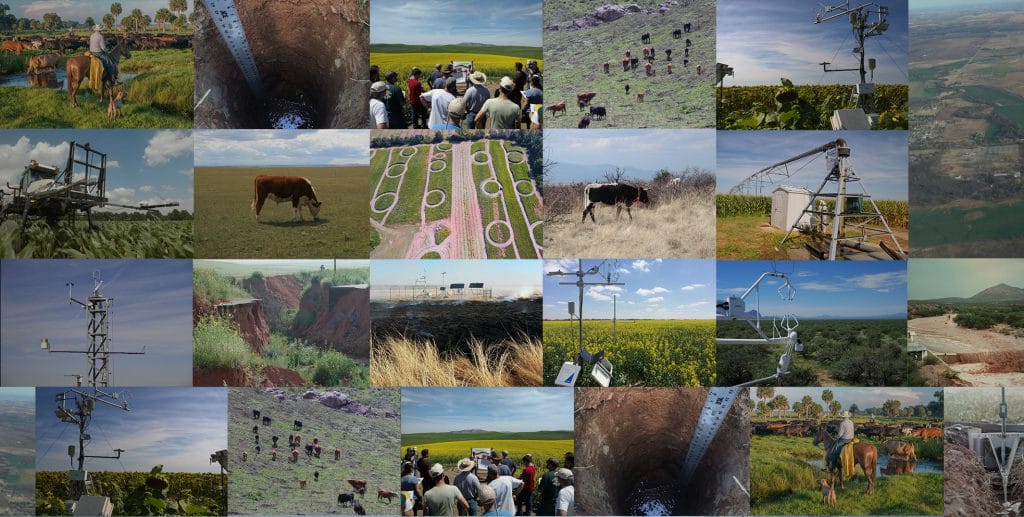
LTAR Network sites represent a partnership between multiple institutions including The United States Department of Agriculture – Agricultural Research Service (USDA-ARS), universities, and private research institutions working in cooperation to achieve these goals.
All of these sites were well-established research locations prior to joining the LTAR network and continue to study local agricultural issues in addition to LTAR research goals. The rich legacy of research and data collection at each site compliments the coordinated research conducted within the LTAR network.
LTAR Network Geography
A spatial overview of the LTAR Network site locations and boundaries as well as related networks geospatial layers. (To enable/disable layers, click on the layers list to the right.)
LTAR Network Sites Summary
Summary matrix describing attributes for each of the 18 LTAR Network sites.
| Site Name (link to site page) | Site Code | Location | Established | Year Joined LTAR | Area (km2) | Network Affiliation | NEON Domain | Major crops, land use, and livestock production | Bibliographies |
|---|---|---|---|---|---|---|---|---|---|
| Archbold-University of Florida | ABS-UF | Lake Placid, FL; Venus, FL; Ona, FL | 1941 | 2014 | 102 | AmeriFlux, GLEON, NutNet, USCRN | D3 – Southeast | Beef cattle, pasture, rangeland, wildlife | |
| Central Mississippi River Basin | CMRB | Columbia, MO (Goodwater Creek Experimental Watershed) | 1971 | 2011 | 490 | CEAP, SCAN | D6 – Prairie Peninsula | Grain cropping systems, some pasture, riparian forest | Long Bibliography |
| Central Plains Experimental Range | CPER | Cheyenne, WY; Nunn, CO | 1935 | 2011 | 865 | LTER, NEON, GRACEnet, NADP, NutNet, SCAN | D10 – Central Plains | Wheat-fallow, rangeland, beef cattle | Long Bibliography |
| Eastern Corn Belt | ECB | Columbus, OH | 1974 | 2013 | N/A | CEAP, GRACEnet | D7 – Appalachians / Cumberland Plateau | Cropland, swine, dairy poultry | |
| Great Basin | GB | Boise, ID | 1961 | 2012 | 239 | CEAP, CZO, NADP, SCAN | D15 – Great Basin | Rangeland, beef cattle, wildlife | Short and Long Bibliographies |
| Gulf Atlantic Coastal Plain | GACP | Tifton, Georgia; (Little River Experimental Watershed) | 1965 | 2012 | 334 | CEAP, NADP, SCAN | D3 – Southeast | Cotton, peanuts, corn, vegetables (~50% irrigated); poultry, beef cattle | Short and Long Bibliographies |
| Jornada Experimental Range | JER | Las Cruces, NM; Monticello, UT (TNC Dugout Ranch) | 1912 | 2011 | 780 | CEAP, COSMOS, LTER, NEON, NWERN, SCAN, UV-B MRP, USCRN, WNBR | D14 – Desert Southwest | Rangeland, beef cattle, wildlife | |
| Kellogg Biological Station | KBS | Hickory Corners, MI | 1927 | 2012 | 13 | LTER, AmeriFlux, NADP, NutNet | D5 – Great Lakes | Row crops, forage crops, bioenergy crops, mixed grasses, prairie, forest, dairy | |
| Lower Chesapeake Bay | LCB | Beltsville, MD, Eastern Shore, MD/DE (LCB Choptank River Watershed) | 1910 | 2013 | 2600 | CASTnet, CEAP, COSMOS, EOS, NADP, GRACEnet, SCAN, UV-B MRP | D2 – Mid Atlantic | Cropland, poultry, dairy, forages, pasture, horticulture | |
| Lower Mississippi River Basin | LMRB | Oxford, MS | 1981 | 2012 | 21.3 | COSMOS, CEAP, SURFRAD, SCAN | D8 – Ozarks Complex | Cotton, corn, soybeans, rice, catfish, sugar cane | Long Bibliography |
| Northern Headwaters | NH | Morris, MN and St. Paul, MN (Soil and Water Management Research) | 1958 | 2011 | 6,200 | Ameriflux, PhenoCam Network, GRACEnet, REAP, Soil Biology Network | Domain D5 -Great Lakes & D6 – Prairie Peninsula | Corn, soybeans, and canning crops, with research into kura clover and intermediate oilseeds, large confined animal feeding operations | Short Bibliography |
| Northern Plains | NP | Mandan, ND (Northern Great Plains Research Laboratory) | 1912 | 2011 | 9.7 | NEON, CEAP, GRACEnet, REAP, SCAN | D9 – Northern Plains | Small grains, row crops, beef cattle on grazing lands | Short and Long Bibliographies |
| Platte River/High Plains Aquifer | PRHPA | Lincoln, NE | 1962 | 2014 | 16500 | AmeriFlux, GRACEnet, REAP, SCAN | D6 – Prairie Peninsula | Cropland, rangeland, beef cattle, biofuels | |
| R.J. Cook Agronomy Farm | CAF | Pullman, WA | 1999 | 2011 | 0.57 | 7 LTAP, GRACEnet, REAP, NADP, SCAN | D15 – Great Basin | Wheat, barley, pulses (peas, lentils, chickpeas) | |
| Southern Plains | SP | El Reno, OK (Little Washita River/Fort Cobb Reservoir Experimental Watersheds) | 1948 | 2011 | 1,423 | CEAP, COSMOS, SCAN | D11 – Southern Plains | Beef cattle, winter wheat, pasture, forages, prairie | |
| Texas Gulf | TG | Temple, TX | 1937 | 2012 | N/A | CEAP, GRACEnet, NutNet, LTBE, SCAN | D11 – Southern Plains | Cropland, rangeland, pasture, remnant prairie | Long Bibliography |
| Upper Chesapeake Bay | UCB | University Park, PA (Upper Chesapeake Bay Experimental Watersheds) | 1968 | 2011 | 1,127 | CEAP, GRACEnet, SCAN | D2 – Mid Atlantic | Row crops, dairy, pasture, forest | Short Bibliography |
| Upper Mississippi River Basin | UMRB | Ames, IA (Upper Mississippi River Basin Experimental Watersheds); Roseomount, MN (ARS St. Paul); Platteville, WI (University of Wisconsin Platteville,Pioneer Farm); Morris, MN (UMRB Swan Lake Research Farm) | 1989 | 2011 | 6,200 | AmeriFlux, CEAP, GRACEnet, SCAN | D6 – Prairie Peninsula | Corn-soybean with livestock (swine, beef, dairy) | Short and Long Bibliographies |
| Walnut Gulch Experimental Watershed | WGEW | Tombstone,AZ (Walnut Gulch Experimental Watershed); Green Valley, AZ (Santa Rita Experimental Range) | 1953 | 2011 | 150 | Ameriflux, CEAP, COSMOS, EOS, GRACEnet, SCAN | D14 – Desert Southwest | Rangeland, beef cattle, wildlife |
ABOUT LTAR
The USDA Agricultural Research Service (ARS) Long-Term Agroecosystem Research network consists of 18 Federal and university agricultural research sites with an average of over 50 years of history. The goal of this research network is to ensure sustained crop and livestock production and ecosystem services from agroecosystems, and to forecast and verify the effects of environmental trends, public policies, and emerging technologies.