LMRB
Lower Mississippi River BasinWho Operates and Manages this LTAR Aite?
The USDA-ARS National Sedimentation Laboratory (NSL), Oxford, MS provides coordination for LTAR research in a network of USDA-ARS locations throughout the basin. Other participating locations within the LMRB network include Stoneville, MS, Houma, LA, Jonesboro, AR, and Portageville, MO.
Description
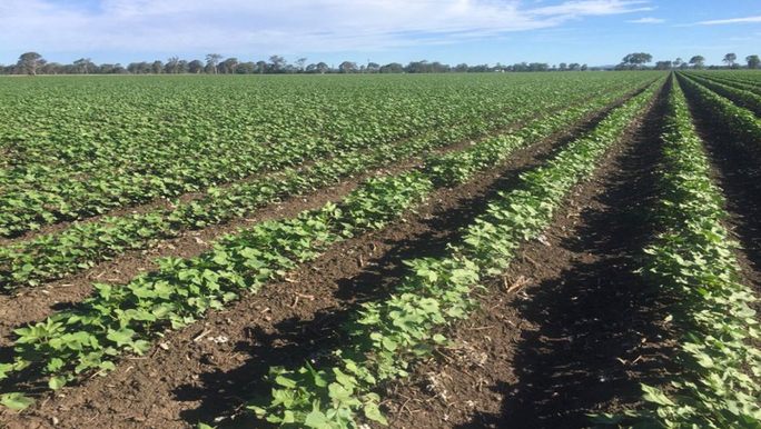
Two primary experimental watershed components of the LMRB-LTAR managed by the NSL are the 625-ha Beasley Lake Watershed (BLW) and the 2132-ha Goodwin Creek Experimental Watershed (GCEW). The watersheds represent two distinct landscapes within the LMRB. GCEW is representative of the Southern Mississippi Valley Loess Land Resource Area (LRA) with highly erodible soils and relatively steep slopes. BLW is representative of the Southern Mississippi River Alluvium LRA with a moderately level landscape, but considerable runoff and sediment loss during heavy rainfall (up to 16 t ha-1 yr-1). The predominant land use within the Southern Mississippi Valley Loess LRA is irrigated row crop agriculture with more than 90% of irrigation derived from the shallow Mississippi River Alluvial Aquifer (MRVAA). The MRVAA is one of the three principal agricultural aquifers in the U.S. along with the California Central Valley and High Plains aquifer systems. Declining groundwater levels within the MRVAA due to irrigation is a major challenge for sustainable crop yields in the region.
Research in GCEW began in 1981 and has included the development and testing of innovative techniques to control erosion in agricultural watersheds. GCEW has since served as a benchmark watershed for erosion research and streambank stability models. Research in BLW began in 1994, and includes assessments of the effectiveness of edge-of-field best management practices (BMPs) for reducing nutrient and soil runoff, and assessing changes in lake water quality and ecology that result from changes in land use and management practices within the watershed. The NSL does not own the land nor control land management; research in both watersheds is conducted through partnerships with various private land-owners.
Other research addressing long-term agricultural sustainability is conducted by all five USDA-ARS locations, all within the Southern Mississippi River Alluvium LRA. Oxford and Stoneville operate long-term research plots near Stoneville, MS, that address cover crop and tillage management in soybean and cotton systems, representing the Southern Mississippi River Alluvium LRA. Jonesboro operates on-farm rice research that addresses irrigation efficiency management including alternative wetting and drying practices. Houma operates field experiments to study effects of row-spacing and post-harvest crop residue management on water availability and productivity in sugarcane. Portageville, MO, conducts research in various row crops to improve irrigation water management and determine benefits and limitations of site-specific technologies for irrigated agriculture.
The LMRB LTAR also includes a growing regional micrometeorological network known as Delta-Flux, collecting water vapor, CO2, and methane fluxes in addition to crop yield data in order to construct estimates of regional gas exchange. The eddy covariance tower network is comprised of sites representing widespread agriculture production, including rice, cotton, corn, soybean, and sugarcane; intensively managed pine forest; and bottomland hardwood forest.
Geography
The LMRB spans 107,000 square miles over portions of Missouri, Arkansas, Tennessee, Mississippi and Louisiana. Over 85% of the LMRB falls into two EPA Level II Ecoregions: the “Mississippi Alluvial Plain” consisting of the alluvial valley and floodplain of the Mississippi River and the “Southeastern Plains” made up largely of the loessal bluff hills along the margins of the alluvial valley.
Instrumentation
Beasley Lake Watershed:
The ARS-NSL currently operates and maintains instrumented samplers at three runoff sites within three different management regimes (i.e. CRP, buffer, and row crop) to compare runoff and changes in soil resources. In 2009 a sediment retention pond was installed on the south part of the lake intercepting the convergence of two major drainage ditches entering the lake. ARS-NSL installed automated samplers to collect water entering the sediment retention pond on the south side of the lake. At each of the eleven BLW runoffs site, storm event or runoff samples are collected using automated pumping samplers activated by acoustic-Doppler water level and area velocity water flow sensors. Lake sampling also occurs at three geo-referenced sites within the lake and has a continuous record of lake water quality from 1995 to present. In 1999 a NRCS SCAN site was installed within the watershed to collect hourly soil moisture, soil temperature, precipitation, wind, and solar radiation data.
Goodwin Creek Watershed:
The ARS-NSL maintains and operates fourteen supercritical V-shaped in-channel measurement flumes and 26 rain gauges. The site of each measuring flume in the watershed is equipped with an instrument house that encloses stilling wells, water/sediment auto-samplers, data loggers, and telemetry equipment for real-time data transfer to the NSL. The watershed is also home to two NRCS SCAN stations (pasture, forest) measuring soil moisture, air temperature, barometric pressure, humidity, dew point, relative humidity, soil temperature, vapor pressure, wind direction, and wind speed at an hourly rate. There is also one NOAA Solar Radiation Budget Network (SRBN) measuring station, which collects continuous observations of long-wave and short-wave radiation, direct and diffuse solar radiation, photosynthetically active radiation, UV-B, and meteorological variables such as wind speed, temperature, and humidity.
Classification System
Farm Resource Regions:Mississippi Portal
Hydrologic Unit Codes (HUC-2): Region 08 (Lower Mississippi)
National Ecological Observatory Network (NEON): Domain D8 (Ozarks Complex)
NRCS Major Land: Common Resource Area 131A (Southern Mississippi River Alluvium)
LTAR Research Emphases
- Cropland plot-scale experiment
- Hydrologic measurements and modeling
- Water quality and ecology measurements and experimentation
- Carbon, water, and energy measurements with flux towers
- Soil health
- Water availability
Muti-site Initiatives
LMRB is participating in the following initiatives:
- Common experiment synthesis (Spiegal/Bestelmeyer)
- Sustainable intensification review (Kleinman)
- Water budgets (Baffaut)
- Water use efficiency (Hoover/Demaria/Bosch/Saliendra)
- Farm modeling – IFSM (Kleinman)
- Soil biology (Peterson)
- Regionalization (Coffin/Ponce/Yasarer)
- DOM Quality (Pisani)
- Nutrient stocks and flows (Huggins)
Major Accomplishments
Other Networks (where data is shared)
- SCAN
- CEAP
Site Name
Lower Mississippi River Basin, Southeast Area, United States
Website
Location
Southeast Area, United States
Established
2014
Area (km2)
277,129
Leader(s)
Martin Locke (RL), J.R. Rigby
ABOUT LTAR
The USDA Agricultural Research Service (ARS) Long-Term Agroecosystem Research network consists of 18 Federal and university agricultural research sites with an average of over 50 years of history. The goal of this research network is to ensure sustained crop and livestock production and ecosystem services from agroecosystems, and to forecast and verify the effects of environmental trends, public policies, and emerging technologies.