UMRB
Upper Mississippi River BasinWho Operates and Manages this LTAR Site?
The Upper Mississippi River Basin (UMRB)-Ames LTAR project includes several cooperating locations in the UMRB watershed. They include Ames, Iowa, Morris, MN, and Platteville, Wisconsin. The Ames location is managed by the USDA-ARS-National Laboratory of Agriculture and Environment (NLAE) which is the lead partner of the UMRB-Ames.
Research at the National Laboratory for Agriculture and the Environment (NLAE) has numerous contributions that align with LTAR strategic goals. Studies are developing resilient cropping systems for regional producers by determining the effects of conventional and aspirational corn-soybean cropping systems on soil nutrient dynamics, nutrient losses in subsurface drainage, soil health, crop nutrient update, and crop yield. Long-term soil health data and crop yields under different agroecosystem management strategies identify the best strategies that improve soil and land health. There is also focus on long-term use of cover crops and how they affect productivity, soil quality/ health and water holding capacity, along with a system-of-systems modeling approach to study interactions and feedbacks. Improved understanding of agricultural decision-making for near-term, multi-season, and adaptation is an innovative approach taken through regional partnerships to improve management decisions through soil, ET, freeze data and other climatology data.
Description
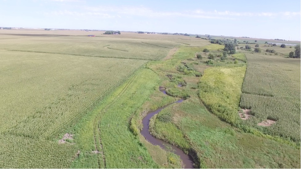
The UMRB-Ames investigates alternative farming systems that sustain or increase production while minimizing natural resource impacts that build on the predominant corn-soybean crop- rotation. Agriculture in the UMRB-Ames and other locations in the upper Midwest are stressed by runoff and wind-driven soil erosion, increased fluxes from cropping systems, and CAFOS (concentrated animal feeding operation), water quality issues, and profitability issues. Diversification of crop production systems and other forms of adaptations offer some opportunity to relieve these stresses. NLAE maintains multiple experimental watersheds in central Iowa with a focus on the interface between agricultural production systems and the environment. These watershed studies help NLAE accomplish its mission of generating information which addresses critical problems in agriculture and watershed management leading to the development of innovative solutions which increase the efficiency of agriculture systems and reduce natural resources impact. There are three primary watershed areas where long term measurements have been performed “connecting” upland and instream processes: North Walnut Creek near Ames, IA, south Walnut Creek near Prairie City, IA (Neal Smith Wildlife Preserve), and the South Fork of the Iowa River near Iowa Falls, IA. The goal in these watershed projects is to quantify the interface of agricultural management practices, soil health and water dynamics, and water quality in the receiving waters. Such detailed and long-term records of measurements at the watershed scale that link contributing source areas to the receiving waters under different history of practices are lacking. The NLAE also conducts plot and farm scale research that complements the watershed scale research. This research explores alternative crop rotations and practices that improve nutrient and water use efficiency, decrease loss of soil and nutrients in runoff and subsurface drainage waters, and improve soil health. Several of these experiments utilize eddy correlation (EC) measurement systems that can provide estimates of evapotranspiration and flux at the field scale. A snapshot of these experiments is depicted in Figure 1.
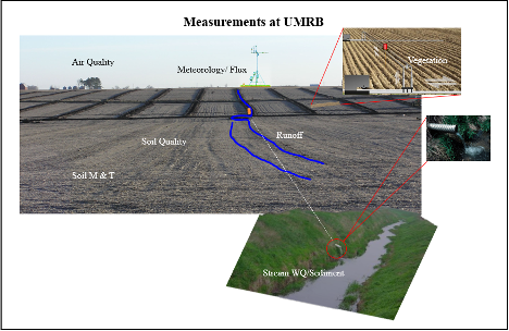
Figure 1. Field scale experiments at UMRB-Ames, connecting land-air, cropping systems with associated soil microbiota, particulate and water fluxes from the uplands to the receiving waters.
Geography
Iowa consists of a series of different landforms. The North Walnut Creek and South Fork watersheds are located in the Des Moines lobe landform, which is often called the prairie pothole region and is characterized by gently, rolling terrain and ridges. Before extensive subsurface drainage system was installed in this landform, the area was characterized by a series of swampy areas (potholes). After the subsurface drains were installed this landform has become intensively farmed. Walnut Creek-South flows through the Neal Smith Wildlife Preserve which is located on the Southern Iowa drift plain and characterizes the southern half of Iowa and consists of rolling hills of Wisconsin-age loess or Illinoian till. This rolling landform is subject to runoff and erosion. Research here addresses how conversion of farmland to reconstructed prairie changes water quality.
Specific to the on-farm site, a majority of the soil is composed of Balaton-Hamerly complex with 1 to 4 percent slopes, followed by Vallers clay loam with 0-2 percent slope. Additional soils found are Parnell silty clay loam (occasionally ponded with 0-1 percent slopes) and Tonka loam. This farmland is generally classified as “prime farmland” or “prime farmland if drained”. The clay loam and silty clay loams provide high water holding capacity in dry periods and challenges when excessively wet.
Instrumentation
Our instrumentation is placed strategically following the drainage network approach at the watershed scale. Observations are also made at the field and plot scale for fundamental understanding of hydro pedological and biochemical processes under different management, treatment and seasonality. Observations at each of the aforementioned scales are described below.
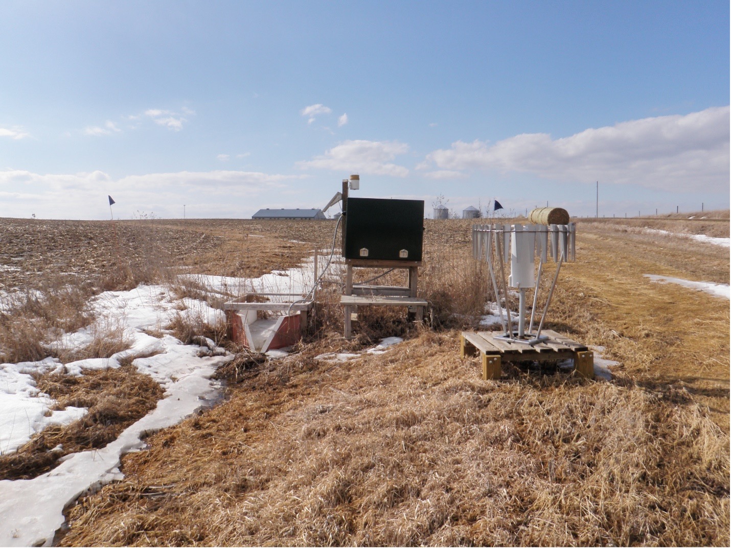
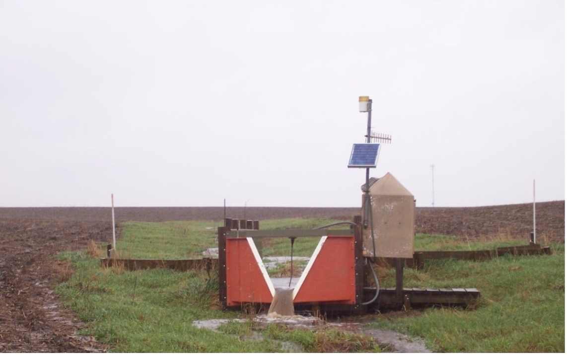
Watersheds. Watershed hydrologic, weather, and water quality are measured using multiple weather stations and stations that measure stream flow and acquire samples of water for laboratory analysis if nutrients, sediment and other constituents.
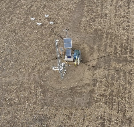
Field-Scale Observatories. Field-scale water and carbon fluxes are measured using eddy flux correlation methods (EC). The EC systems are comprised of a three-dimensional sonic anemometer (CSAT3 Campbell Scientific Inc. Logan, UT1) and a fast response open path infrared gas analyzer (IRGA) (LI7500 LICOR Inc., Lincoln, NE). In both the corn and soybean fields in our research farms, EC instrument height is maintained on the 10 m towers at approximately 2 h (where h = canopy height in m) above the surface. The sampling frequency for the EC systems is 20 Hz with all of the high frequency data directly transmitted to the laboratory. Each of the sites is equipped with a meteorological station to monitor meteorological variables, e.g., air temperature, relative humidity, solar radiation, precipitation, and soil temperature. Ancillary instrumentation on each tower includes a 4-component net radiometer (Rn) (CNR-1 Kipp & Zonen Inc., Saskatoon, Sask.), soil heat flux plates (G) (REBS HFT-3) Cu-Co Type T soil thermocouples, two high precision infrared radiometric temperature sensors (IRT 15º fov) (Apogee Instruments Inc., Logan, UT) and an air temperature/ relative humidity (Ta) (RH) sensor (Vaisala HMP-35, Campbell Scientific Inc. Logan UT). The Rn, air temperature/humidity and one IRT (45° angle of view) sensor are mounted 4.5 m above ground level (AGL). The second IRT sensor is located 0.15 m AGL with a nadir view providing continuous radiometric temperatures of the soil surface. Four soil heat flux plates are placed 0.06 m below the soil, two within the plant row and two within the inter-row space. Pairs of soil thermocouples are placed 0.02 and 0.04 m below the surface and above each soil heat flux plate. Soil water content in the top 0.1m at each site will be measured with Delta-T Theta Probes (Dynamax Houston TX) and together with soil temperature data used to compute the storage component of the soil heat flux. Soil water content profiles are measured with CSI655 probes (Campbell Scientific Inc. Logan UT) at depths of 0.1. 0.2, 0.3, 0.5 and 1.0 m. The sampling frequency for the ancillary instrumentation is 0.1 Hz (10 s) with measured values stored as 15 min averages.
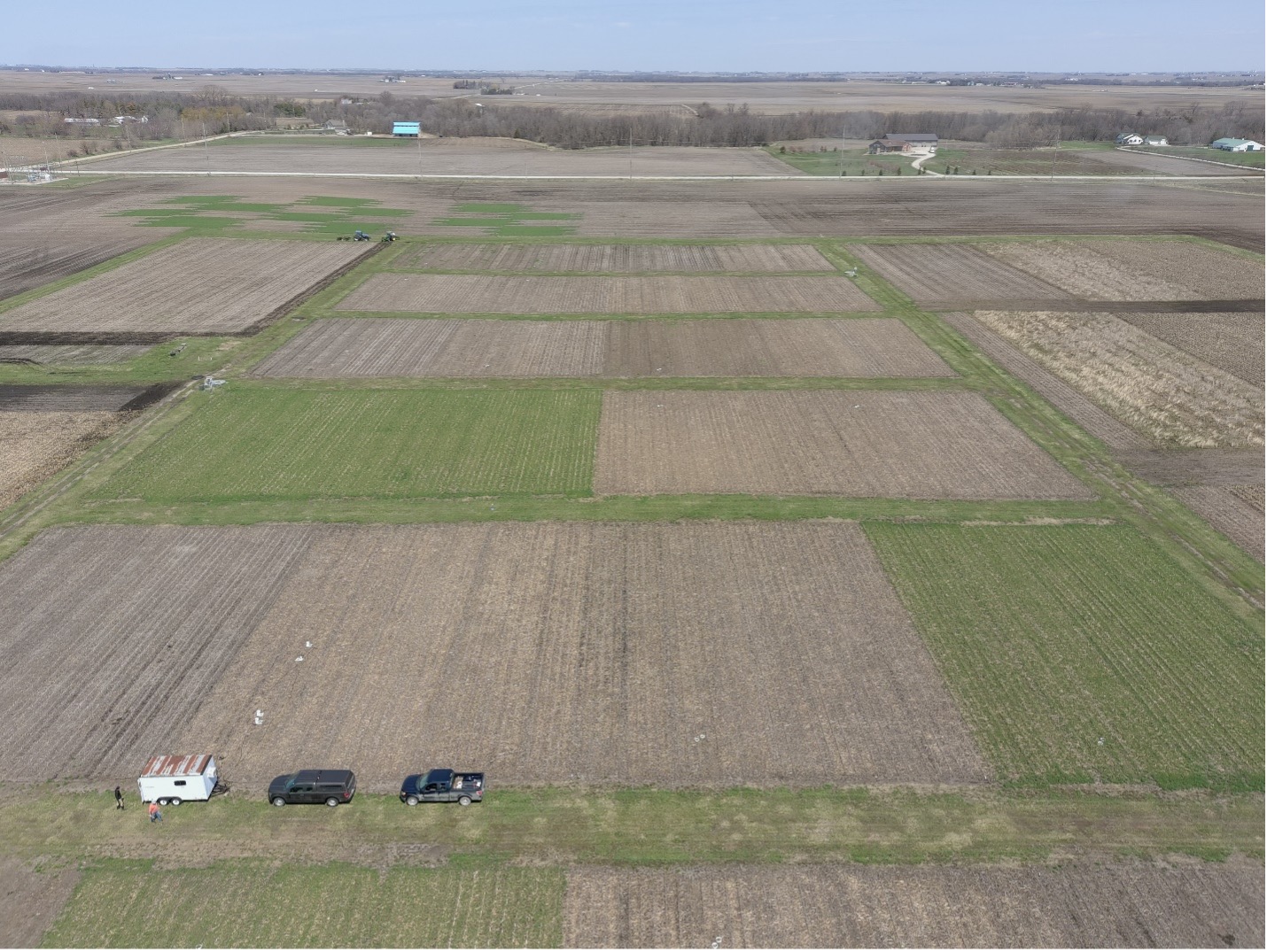
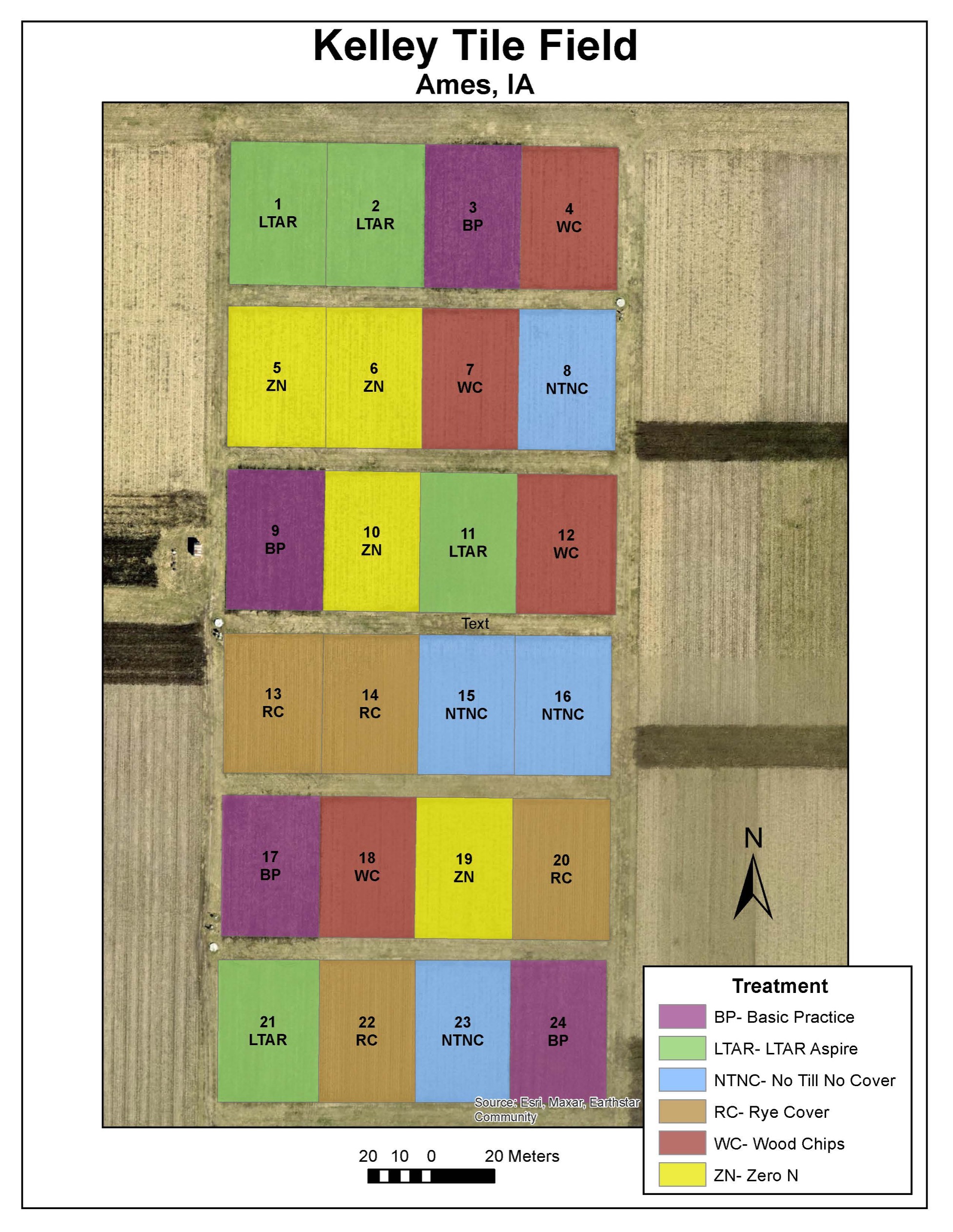
Intensive soil sampling has been conducted at the two Observatory sites nested within the Walnut Creek-North and SFIR watersheds. At the Brooks and Coles fields, soil samples have been collected at 50 m grid points to a depth of 1.2 m. in the Brooks field, this grid sampling was conducted in the fall of 2005 and 2016 and in the Coles field in 2016 and 2017. Each core has been divided into 15 cm layers and separated by sieving into different size fractions. Each size fraction has been analyzed for texture, C and N, content, POM, and aggregate stability with the wet sieving method and rainfall impact. These data will be compared to the carbon fluxes obtained from the EC system systems to verify gains or losses of carbon. Common Experiment. Kelley Farm in Boone County is used for the LTAR network Common Experiment. Here a “business as usual” treatment (corn-soybean rotation with spring-applied N fertilizer and tillage) is compared against alternatives that all have the corn-soybean rotation with (a) no-till with N applied by late spring nitrate test (LSNT); (b) no-till with N applied by late spring nitrate test (LSNT) and a winter rye cover crop; (c) N applied by LSNT with winter camelina grown for oil seed following corn. Replicated plots are equipped with individual tile drains that allow measurement of drainage water and loads of nitrate and phosphorus. The addition of winter crops (camelina or rye) are expected to improve soil health and reduce nutrient losses. Export of nitrate to the Gulf of Mexico is a significant concern in the UMRB.
Data Types:
The types of core data being collected from sensors and other instruments include stream water quality and flow, soil states, biological, and meteorological data. This includes:
- Land-Atmosphere
- LiDAR datasets
- Eddy flux for momentum, heat, water vapor, gas exchanges
- Wind speed and direction (sensors)
- Solar radiation and temperature (sensors)
- Precipitation and through-fall (samplers)
- Wet and dry deposition (samplers)
- Vegetation and associated microbiota
- Above and belowground vegetative
- Microbial biomass
- Relations between ET and species composition and structure
- Soil/plant respiration, net ecosystem exchange
- Soil (vadose zone)
- Solid phase (campaign sampling for spatial characterization)
- Texture and physical characterization
- Organic matter content
- Elemental composition and mineralogy
- Fluid (water/air/gas) phases (sensors and samplers for time series) from and within the soil medium
- Soil moisture (sensors)
- Soil temperature (sensors)
- Soil solution chemistry (samplers)
- Soil gas chemistry (samplers/sensors)
- Rates of infiltration and groundwater flow
- Tile flows
- Potentiometric head and temperature (sensors)
- Groundwater chemistry (samplers/sensors)
- Gas chemistry (samplers/sensors)
- Solid phase (campaign sampling for spatial characterization)
- Surface water
- Discrete and instantaneous discharge (flumes, weirs, stage sensors)
- Channel morphology and bank processes
- Stream water chemistry, dissolved and suspended (samplers/sensors)
- Sediment and biota (samplers/sensors)
Classification System
Farm Resource Regions: Heartland
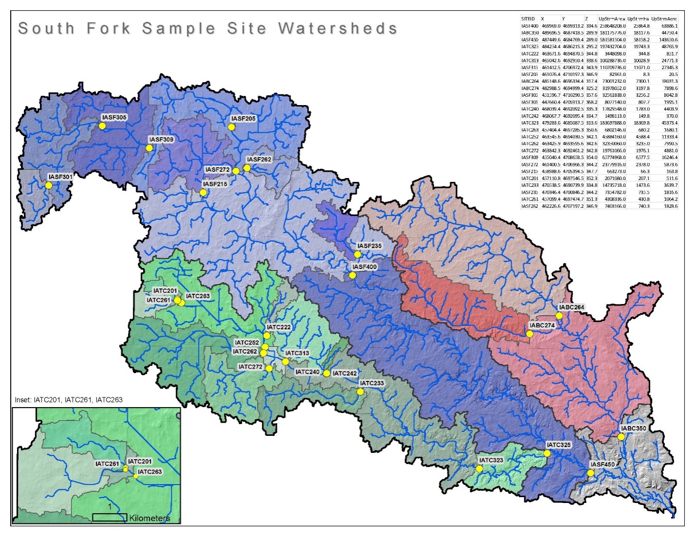
Hydrologic Unit Codes (HUC-2): 07 – Upper Mississippi River, 07 – Upper Mississippi Region; Walnut Creek Watershed: 0708020808; South Fork – Upper Iowa River Watershed: 07080207
National Ecological Observatory Network (NEON): Domain D6 – Prairie Peninsula
NRCS Major Land: 103 – Central Iowa and Minnesota Till Prairies
LTAR Research Emphases
- Alternative crop rotations that are productive, sustainable and provide ecosystem services.
- Carbon, water, and energy measurements with flux towers
- Crop rotations and cover crops
- Reduced tillage
- 4R (Right source, Right rate, Right time, and Right place) nutrient management, silvopasture, and organic production with extended crop rotations.
- New edge of the field, best management practices
Collaborators
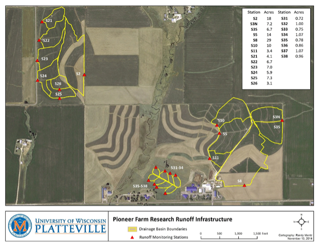
The Upper Mississippi River Basin-Ames LTAR includes the collaborations of NLAE with the USDA-ARS at the North Central Soil Conservation Research Laboratory in Morris, MN and the Soil and Water Management Research Unit in St. Paul, MN, and the Pioneer Farm at the University of Wisconsin, Platteville, WI. There are several other ARS and non-ARS collaborators and stakeholders who partner with UMRB-Ames on a number of projects including modeling simulations within the UMRB-Ames sites.
Other NLAE collaborations can be viewed at:
- https://www.ars.usda.gov/research/collaborations/?modeCode=50-30-15-00
- Working Groups – LTAR Network (usda.gov)
- Software : USDA ARS
- Iowa-SouthFork : USDA ARS
- NASA Jet Propulsion Laboratory – SBG Group
- ISU College of Agriculture
- IAWA and State Agencies`
Other Networks (where data is shared)
- • Ameriflux
• CEAP
• GRACEnet
• Phenocam images are shared on the National Phenocam Network.
• EMIT Home – EMIT (nasa.gov)
Site Name
Upper Mississippi River Basin
Website
- National Laboratory for Agriculture and The Environment: USDA ARS
- Soil Management Research: USDA ARS
- Pioneer Farm | UW-Platteville (uwplatt.edu)
- Soil and Water Management Research: St. Paul, MN
Location
- UMRB (Main site) – Ames, IA
- UMRB – Platteville, WI
- UMRB – Morris, MN
- UMRB – St. Paul, MN
Established
1990 (Walnut Creek-North), 1992 (Brooks), 2000 (Kelley), 2001 (South Fork), 2016 (Coles/Williams)
Area (km2)
6200
Leader(s)
Thanos N. Papanicolaou (Ames, IA), Sharon Weyers (Morris, MN), Dennis Busch (University of Wisconsin Platteville), Brent Dalzell (St Paul, MN)
GIS Layers
ABOUT LTAR
The USDA Agricultural Research Service (ARS) Long-Term Agroecosystem Research network consists of 18 Federal and university agricultural research sites with an average of over 50 years of history. The goal of this research network is to ensure sustained crop and livestock production and ecosystem services from agroecosystems, and to forecast and verify the effects of environmental trends, public policies, and emerging technologies.