CAF
R. J. Cook Agronomy FarmWho Operates and Manages this LTAR Site?
Fields included in CAF are owned by WSU or cooperating individuals. These fields are co-managed by USDA-ARS Northwest Sustainable Agroecosystems Research unit with WSU or the private owner, respectively. A steering committee is composed of scientists from USDA-ARS, Washington State University, University of Idaho, and Oregon State University.
Description
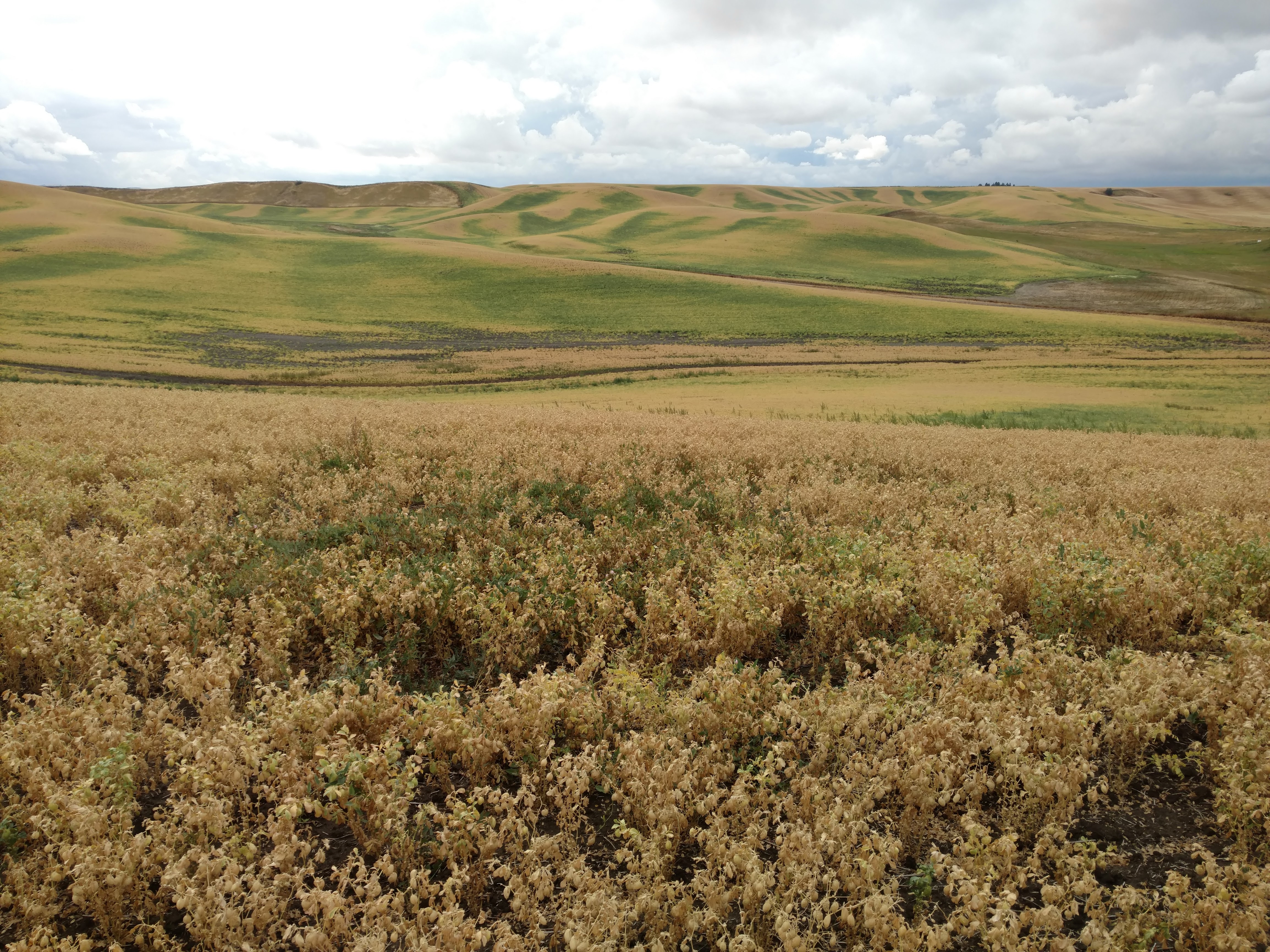
CAF combines site-specific and regional research efforts to advance sustainable agricultural systems. At the site-specific scale, the Cook Farm (http://css.wsu.edu/facilities/cook/) was launched as a long‐term, direct‐seed cropping systems research program by a team of USDA‐ARS and Washington State University (WSU) scientists in 1998. Process-oriented and applied research is conducted at plot, landscape and farm scales to advance knowledge of field-scale biophysical and economic processes with the overall goal to advance sustainable agroecosystems and precision agriculture technologies. At the regional scale, research is extended to the dryland cropping region of the inland Pacific Northwest and includes long-term studies as well as crop modeling and other research contributing to sustainable agriculture.
Three major agroecosystem classes (AEC) occur across the region based on the proportion of fallow that occurs within a rotation. The grain-fallow AEC is defined as a field that is over 40 % fallow. The annual crop-fallow transition AEC is defined as a field that is between 10 % and 40 % fallow. And the annual crop AEC is defined as a field that is less than 10 % fallow.
Geography
CAF combines site-specific and regional research efforts to advance sustainable agricultural systems. At the site-specific scale, the Cook Farm (http://css.wsu.edu/facilities/cook/) was launched as a long‐term, direct‐seed cropping systems research program by a team of USDA‐ARS and Washington State University (WSU) scientists in 1998. Process-oriented and applied research is conducted at plot, landscape and farm scales to advance knowledge of field-scale biophysical and economic processes with the overall goal to advance sustainable agroecosystems and precision agriculture technologies. At the regional scale, research is extended to the dryland cropping region of the inland Pacific Northwest and includes long-term studies as well as crop modeling and other research contributing to sustainable agriculture.
Three major agroecosystem classes (AEC) occur across the region based on the proportion of fallow that occurs within a rotation. The grain-fallow AEC is defined as a field that is over 40 % fallow. The annual crop-fallow transition AEC is defined as a field that is between 10 % and 40 % fallow. And the annual crop AEC is defined as a field that is less than 10 % fallow.
Instrumentation
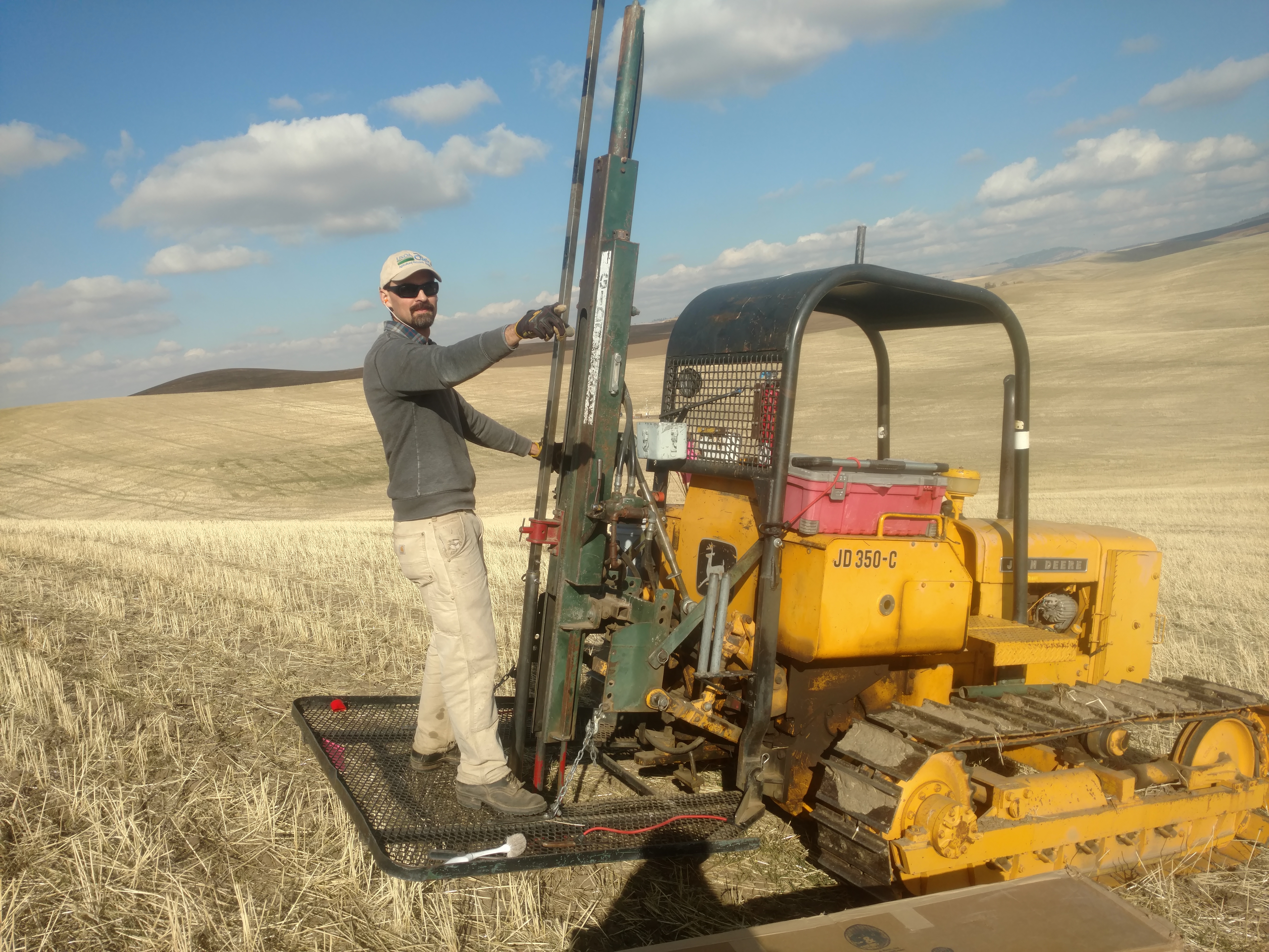
At the site-specific scale, baseline sampling at the eastern watershed of the Cook Farm was initiated in 1998 when 369 geo-referenced points were established in a non-aligned systematic grid composed of 30.84 m grid cells with one point randomly distributed within each grid cell. These locations serve as sampling and monitoring points for numerous studies including soil C and N processes, landscape hydrology, water quality, GHG monitoring, weed seed-bank dynamics, soil-borne pathogens, residue management, precision agriculture, direct-seed cropping systems, biophysical modeling, economic analyses.
A second non-aligned systematic grid of 163 geo-referenced points were established on a second western watershed at the Cook Farm in 2017.
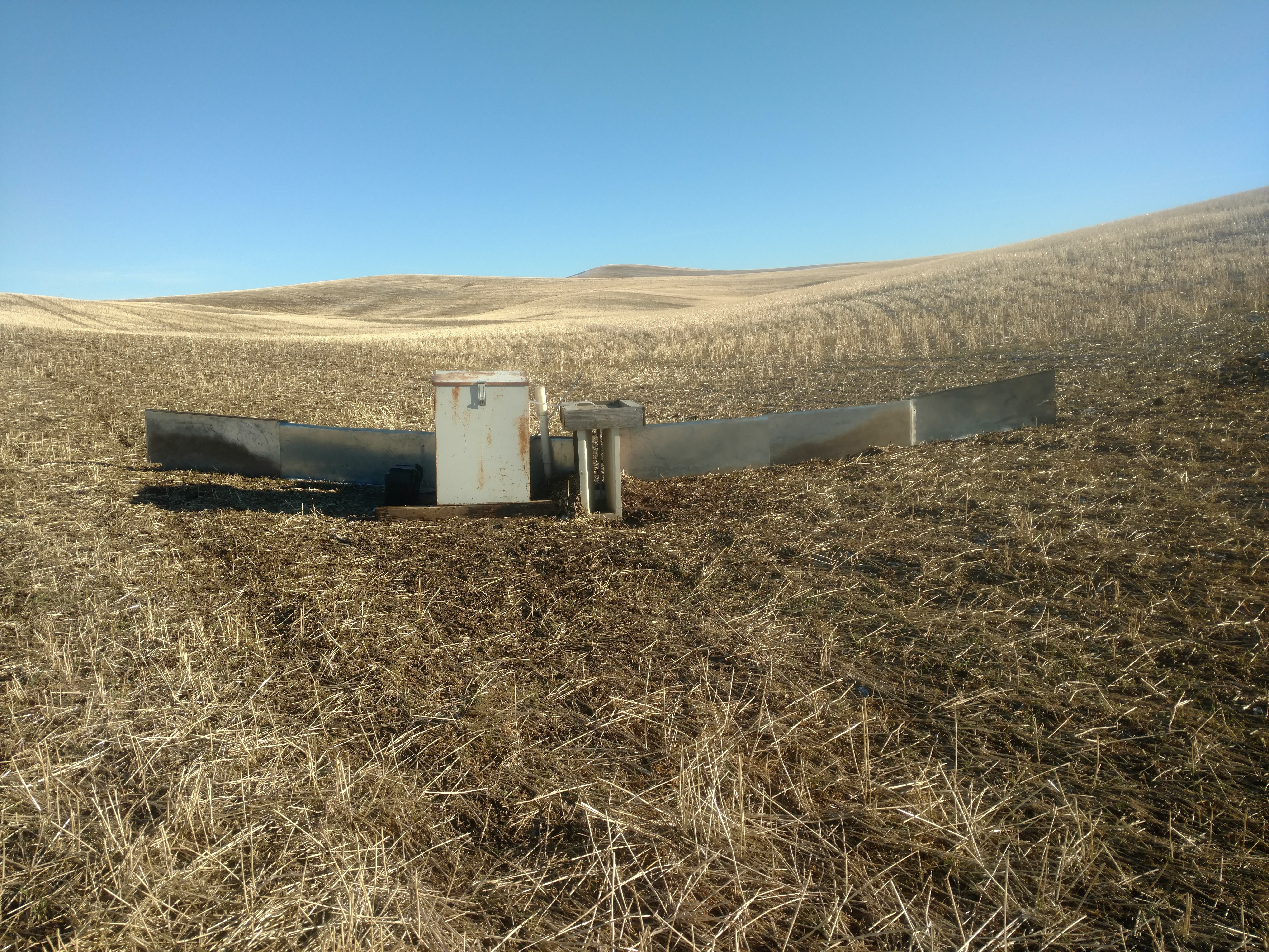
Flumes were first installed in 1999 to measure water quality and surface runoff at 15-min intervals. Currently there are two flumes to measure tile drain flow and two surface level flumes, all located at the Cook Farm.
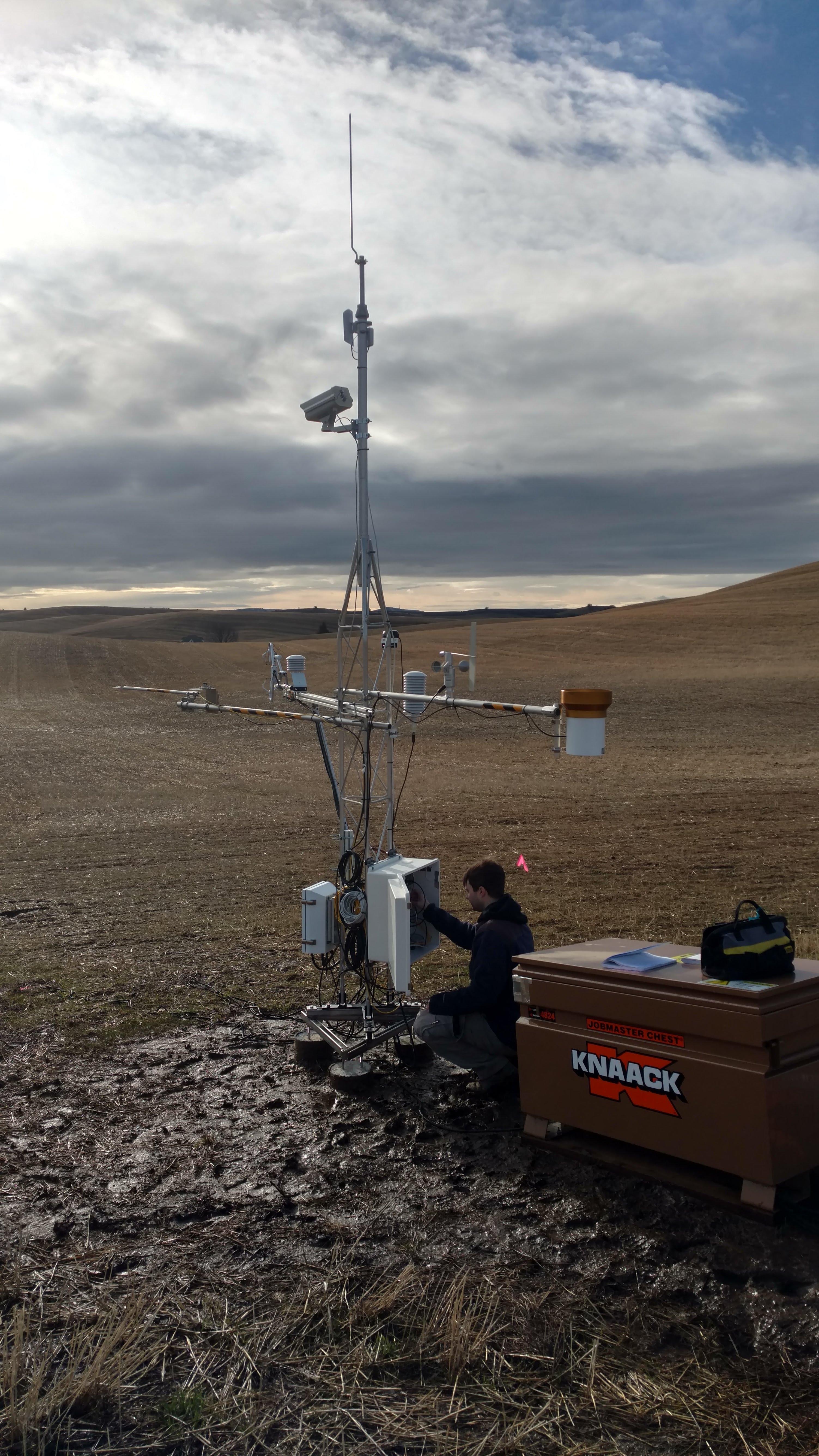
A SCAN weather station was established in 2013.
In 2012, two eddy covariance towers were installed at the Cook Farm. These towers were relocated in 2017 to a permanent location and their sensor array was expanded to provide a near-continuous assessment of meteorological, soil moisture and temperature, and energy/water/carbon dioxide flux measurements under two paired watersheds.
Classification System
CAF research is conducted across a large region that spans multiple classification values. The following are for the Cook Farm, which hosts the most intensive research efforts.
Farm Resource Regions : Basin and Range
Hydrologic Unit Codes (HUC-2) : Region 17 (Pacific Northwest Region)
National Ecological Observatory Network (NEON) : Domain D15 (Great Basin)
NRCS Major Land : B (Northwestern Wheat and Range Region) 9 (Palouse and Nez Perce Prairies)
LTAR Research Emphases
- Assess the existing health of agroecosystems and the long-term prospects for their continued productivity and profitability
- Provide a landscape perspective for studying agricultural systems and policies that emphasize connections to local and regional environments
- Address critical needs for investment in education and training for future farmers and stakeholders.
Muti-site Initiatives
- Common experiment synthesis (Spiegal/Bestelmeyer)
- Water balance (Baffaut)
- Wind erosion network (Webb)
- Phenocam (Browning)
- Watershed modeling (Kleinman)
- Innovations in Data Management (Campbell, Heilman, Sadler)
Major Accomplishments
List of accomplishments
Other Networks (where data is shared)
- Ameriflux
- SCAN
- Phenocam
Site Name
R. J. Cook Agronomy Farm
Website
Location
Dryland cropping region of the Inland Pacific Northwest
Established
1998
Area (km2)
The CAF region is 93809.45 km2 with multiple research fields embedded within. The primary research is conducted on the Cook Farm (0.51 km2).
Leader(s)
Dave Huggins (USDA-ARS), Scot Hulbert (WSU), Erin Brooks (UI), Ian Burke (WSU), Sanford Eigenbrode (UI), Kent Keller (WSU), Chad Kruger (WSU), Timothy Paulitz (USDA-ARS), Brenton Sharratt (USDA-ARS), Claudio Stockle (WSU)
ABOUT LTAR
The USDA Agricultural Research Service (ARS) Long-Term Agroecosystem Research network consists of 18 Federal and university agricultural research sites with an average of over 50 years of history. The goal of this research network is to ensure sustained crop and livestock production and ecosystem services from agroecosystems, and to forecast and verify the effects of environmental trends, public policies, and emerging technologies.