Wind Erosion
Working GroupMission/Vision
Enhance wind erosion monitoring and assessment capabilities through a National Wind Erosion Research Network to support management.
Objectives
- Support basic research underpinning wind erosion monitoring, modeling, and management across all land use and land cover types.
- Improve the availability of wind erosion decision-support tools for managers and agencies.
- Integrate wind erosion analysis tools with farming systems models to support sustainable intensification in US agroecological systems.
- Facilitate collaboration and integration of monitoring and research programs to increase the impact of wind erosion research for management, planning and policy.
Activities
- Expand National Wind Erosion Research Network to include new sites in Colorado, Arizona, California, Nevada and Idaho.
- Develop collaborative research projects linking data and expertise across rangeland and cropland sites.
- Calibrate and validate physically-based wind erosion model and integrate with the Agricultural Policy / Environmental eXtender (APEX) farming systems model.
- Produce national wind erosion assessment integrating BLM Assessment, Inventory and Monitoring (AIM) and NRCS National Resources Inventory (NRI) datasets.
- Evaluate wind erosion responses and feedbacks of business-as-usual and aspirational management strategies across the LTAR network.
- Develop database system linking wind erosion data and analyses to AIM database, ecological site descriptions in the Ecosystem Dynamics Interpretive Tool (EDIT), National Agricultural Library (NAL) and DataONE.
Accomplishments
- Established multi-partner National Wind Erosion Research Network in collaboration with the USDA ARS, NRCS, Bureau of Land Management (BLM), US Geological Survey (USGS), Department of Defense and The Nature Conservancy.
- Published Standard Methods Protocol for Wind Erosion Research and Model Development.
- Developed website and data portal for the National Wind Erosion Research Network.
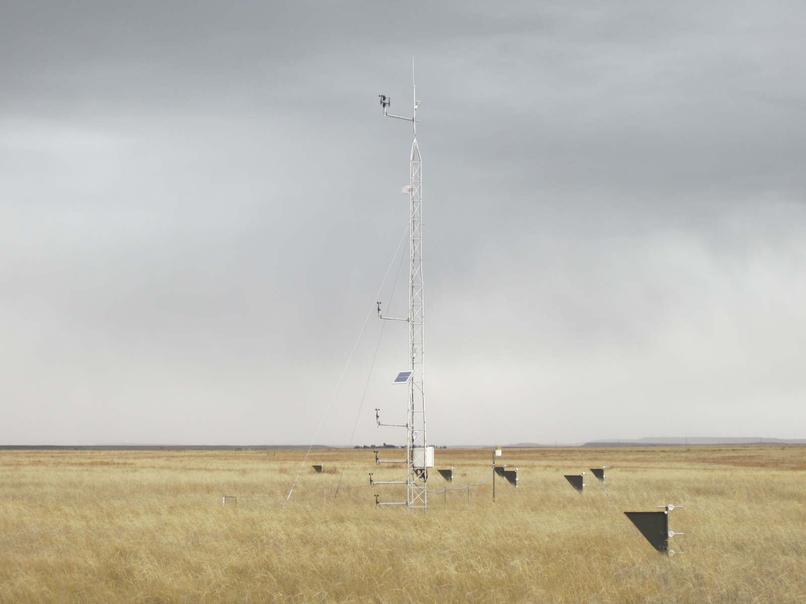
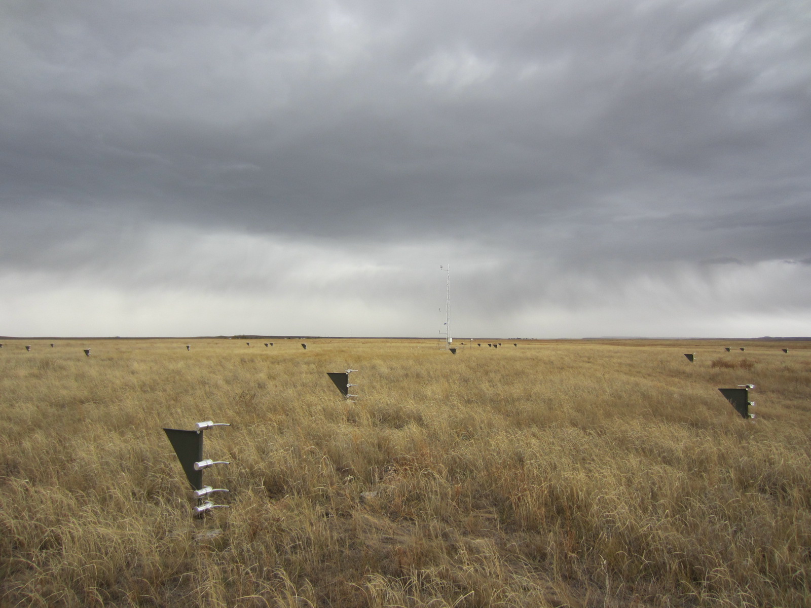
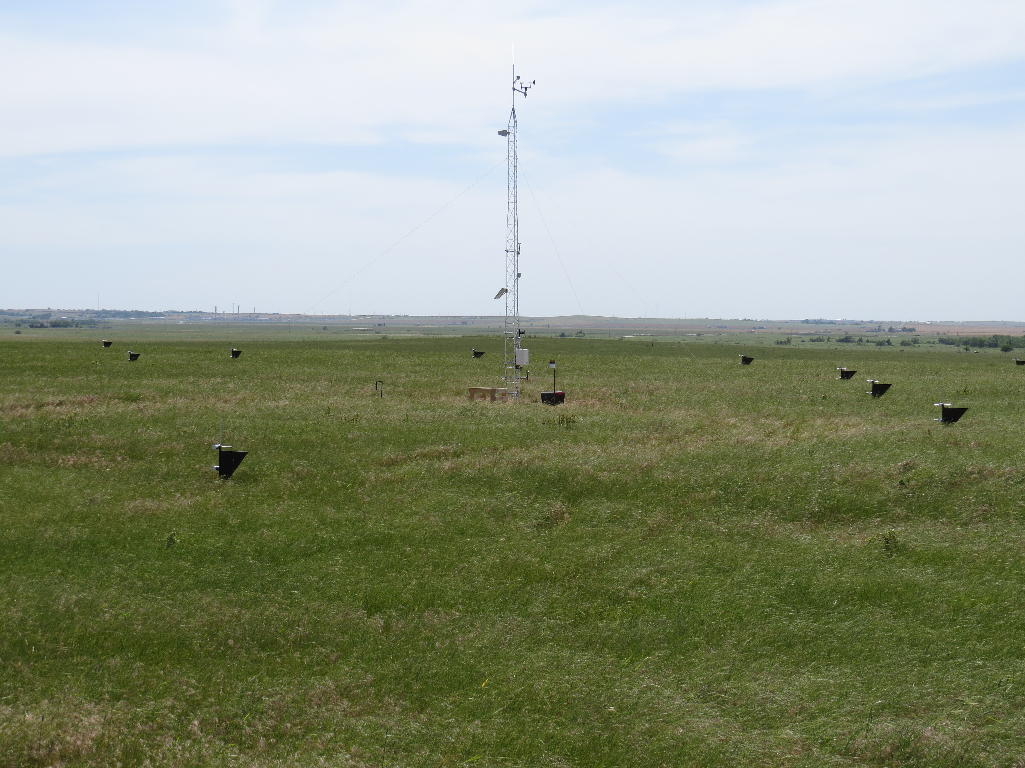
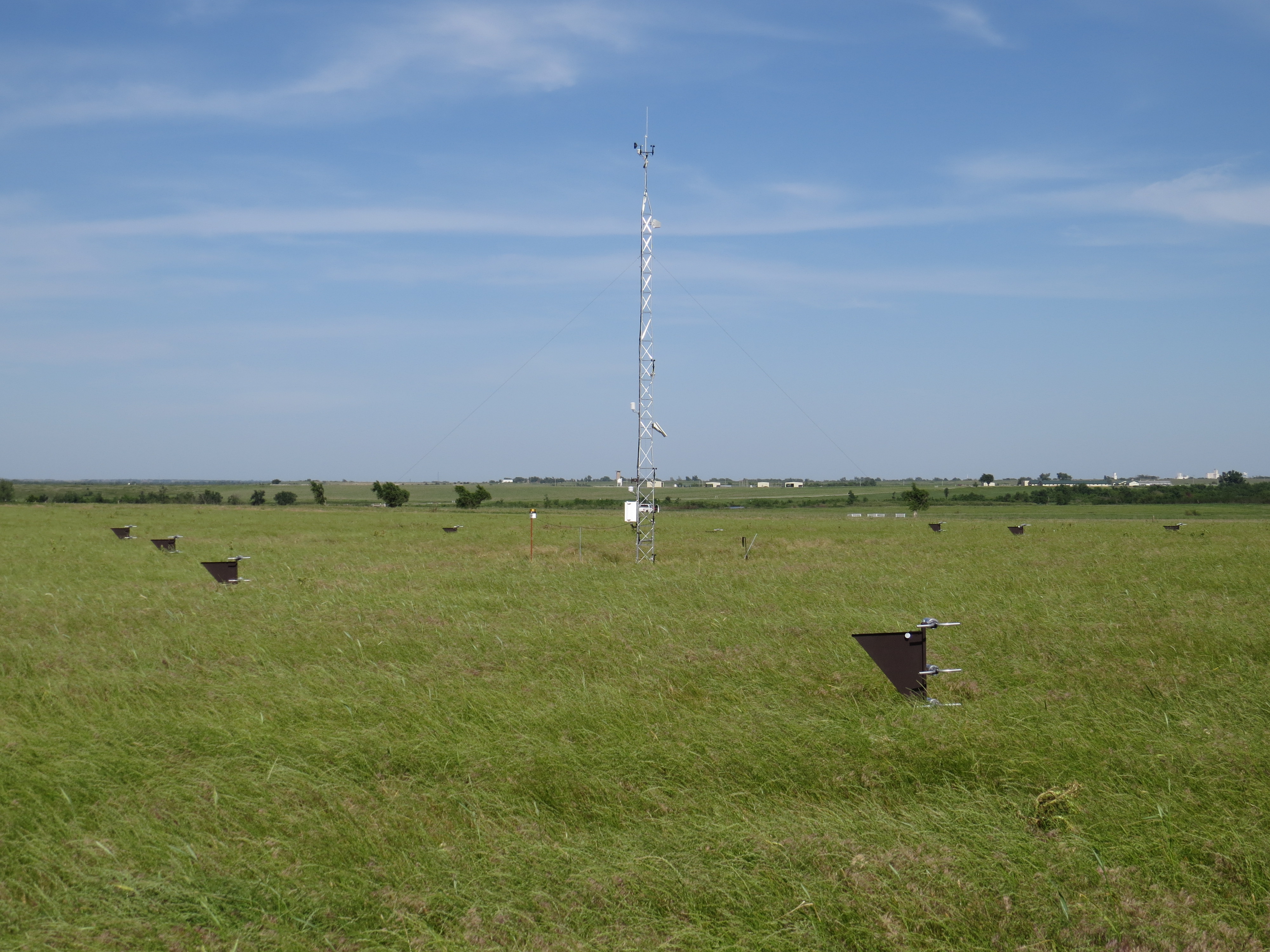
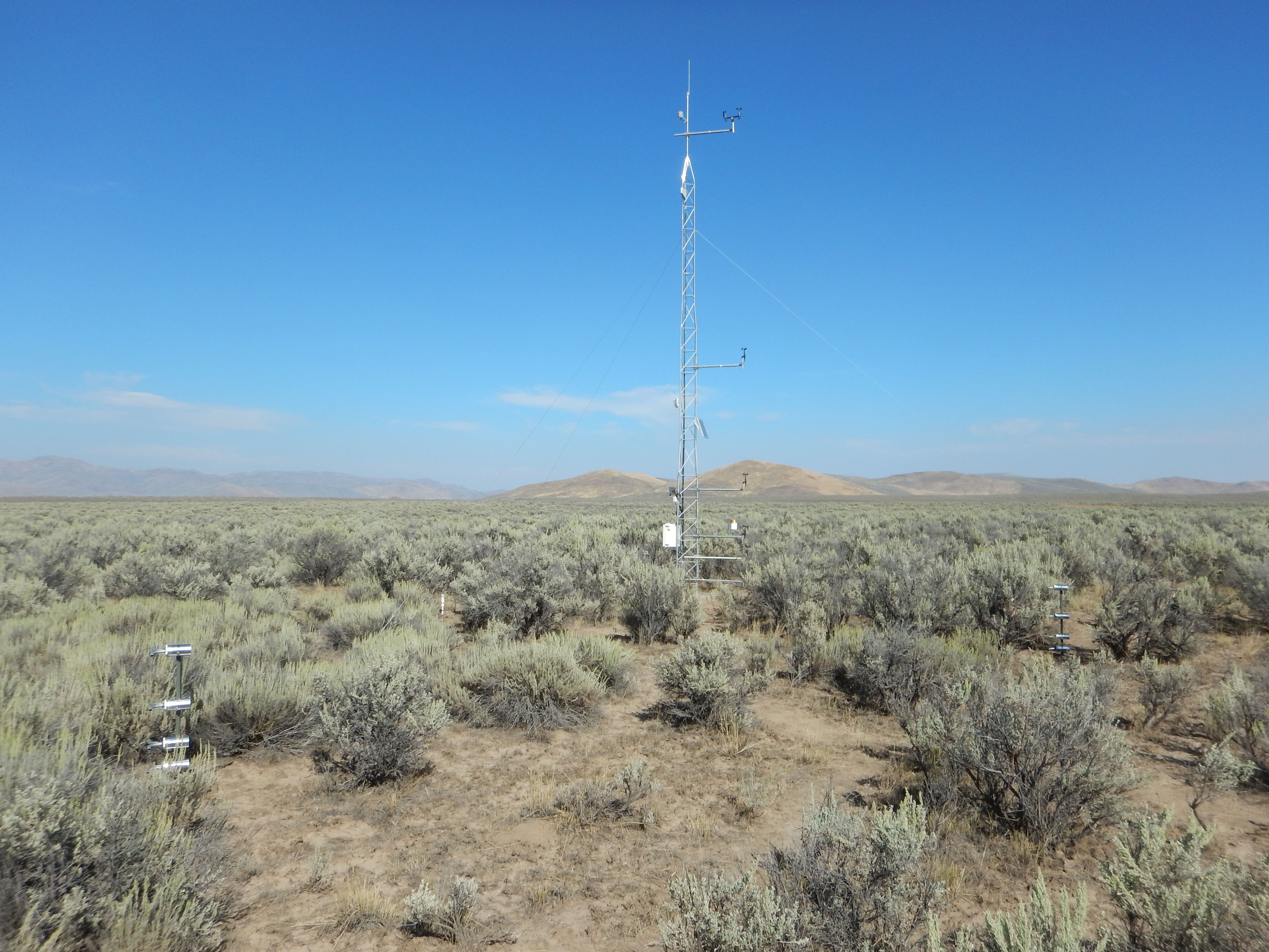
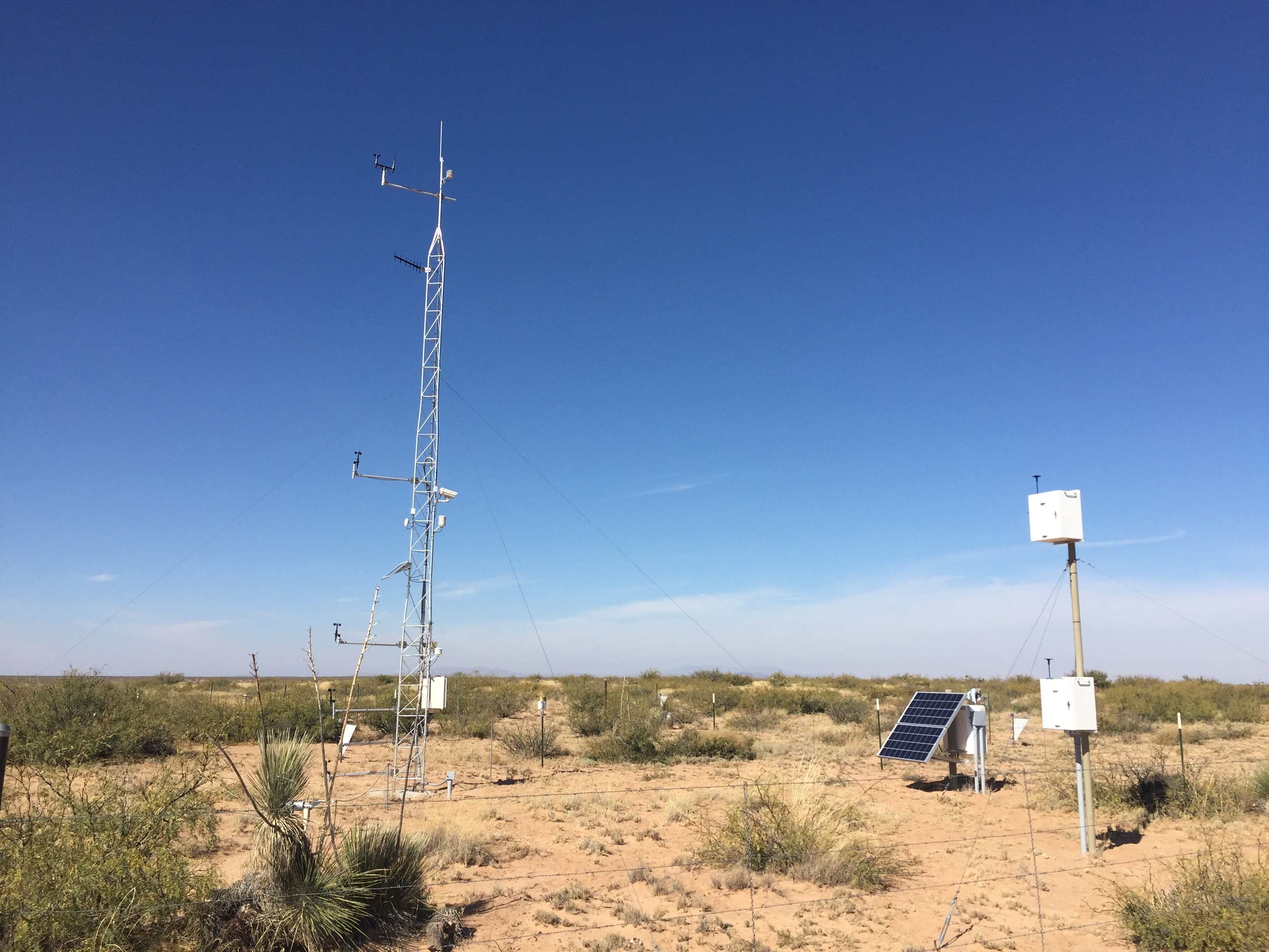
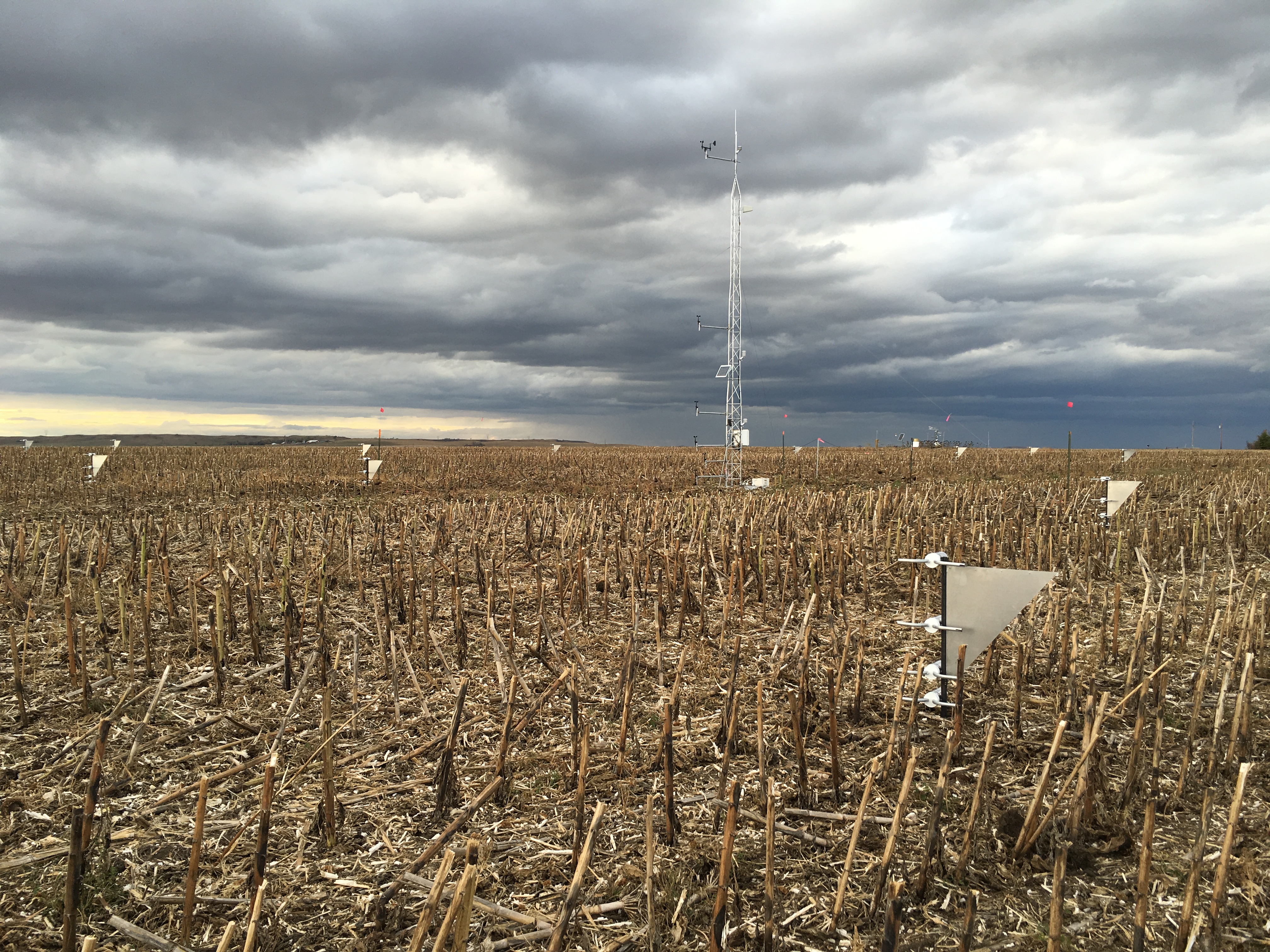
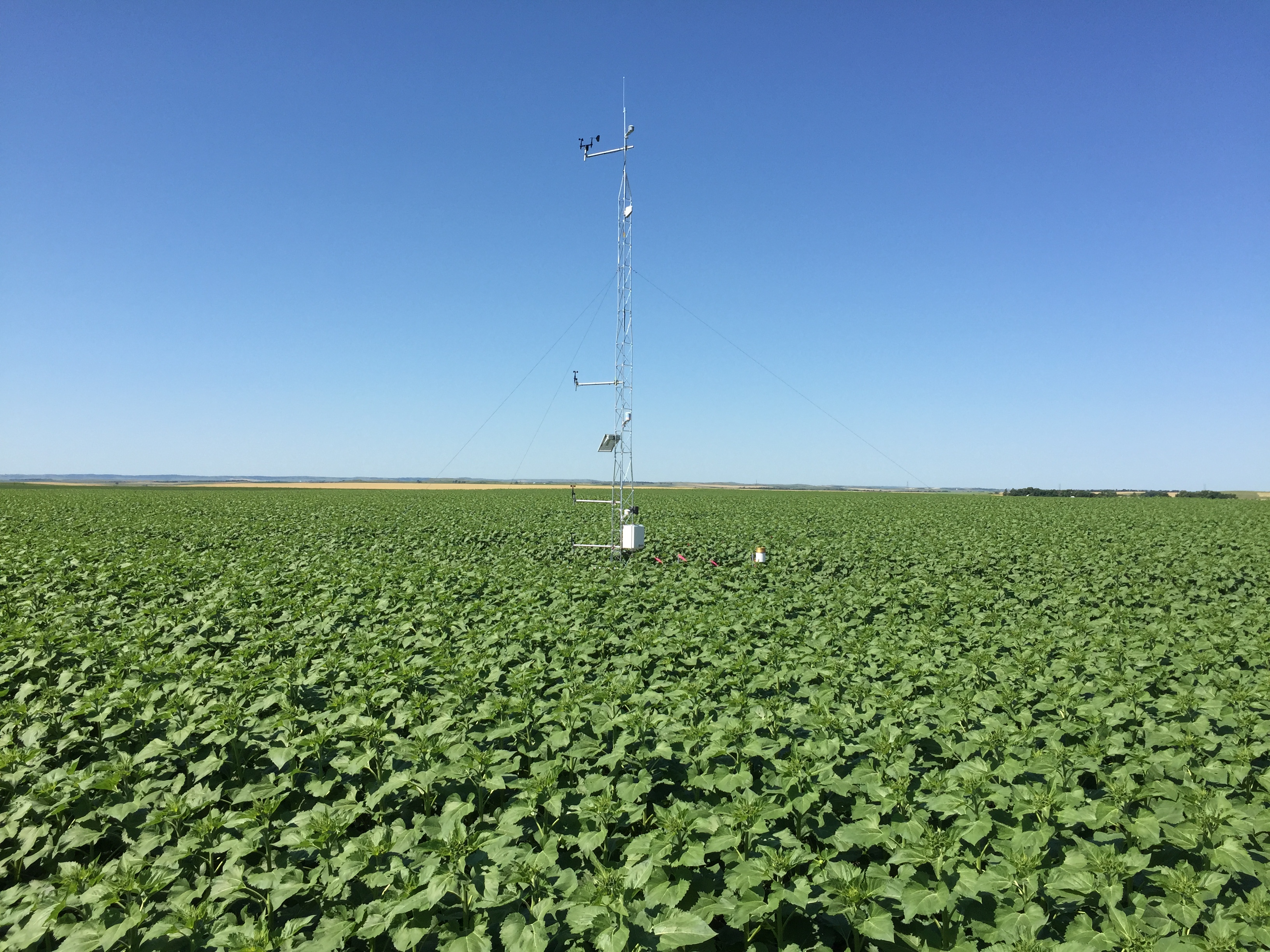
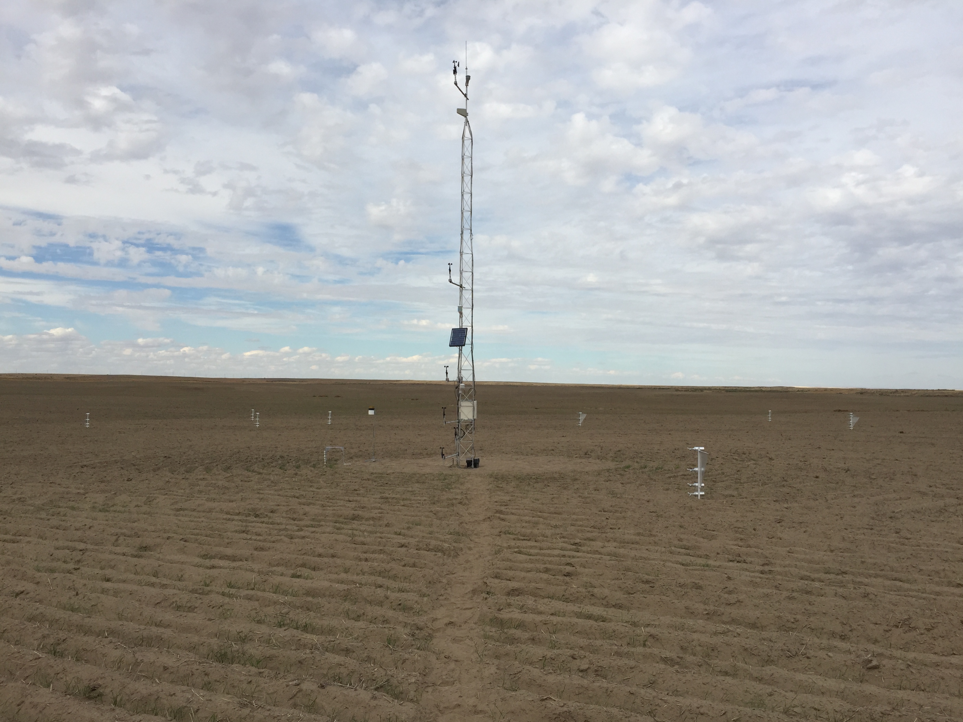
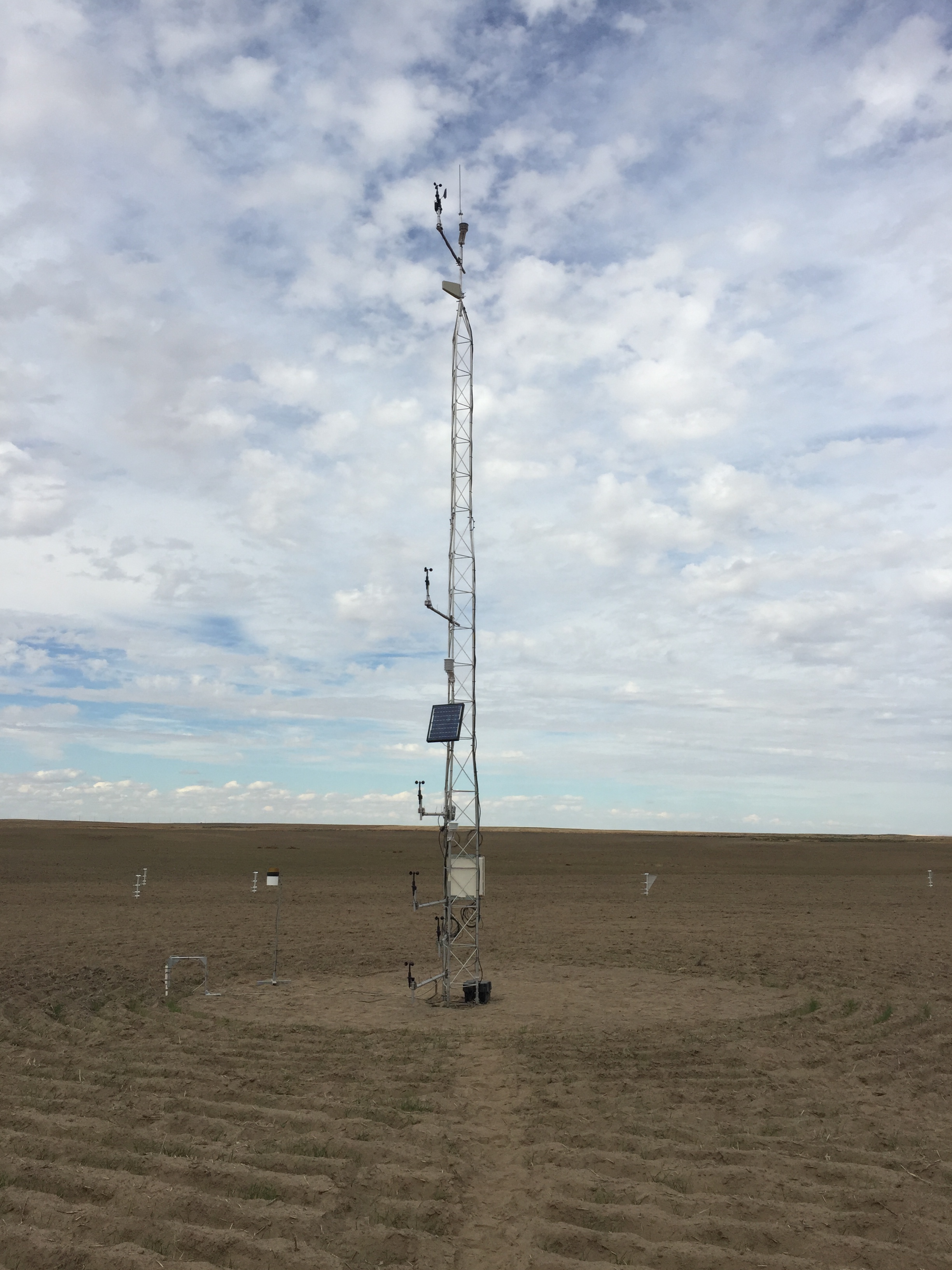
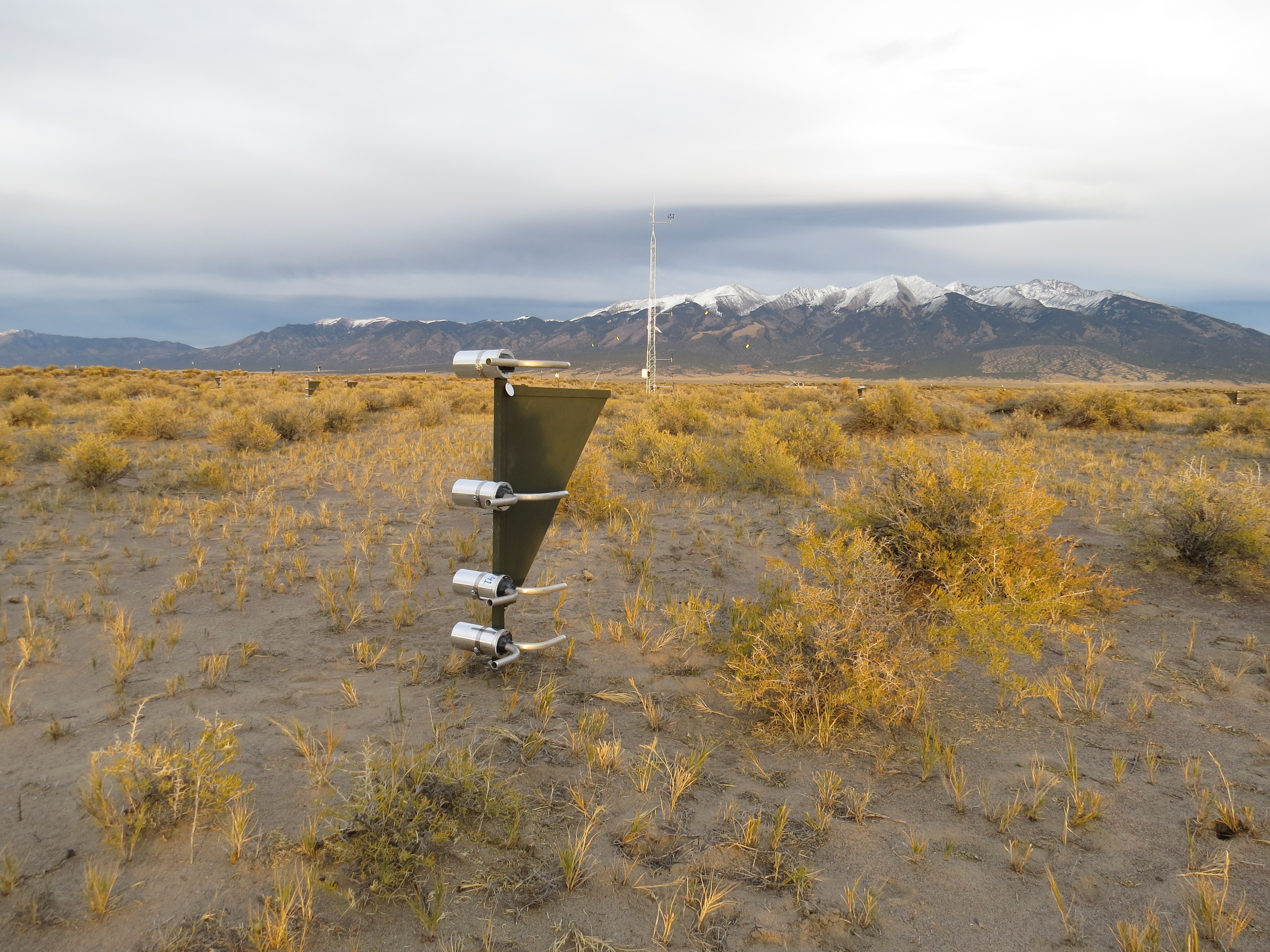
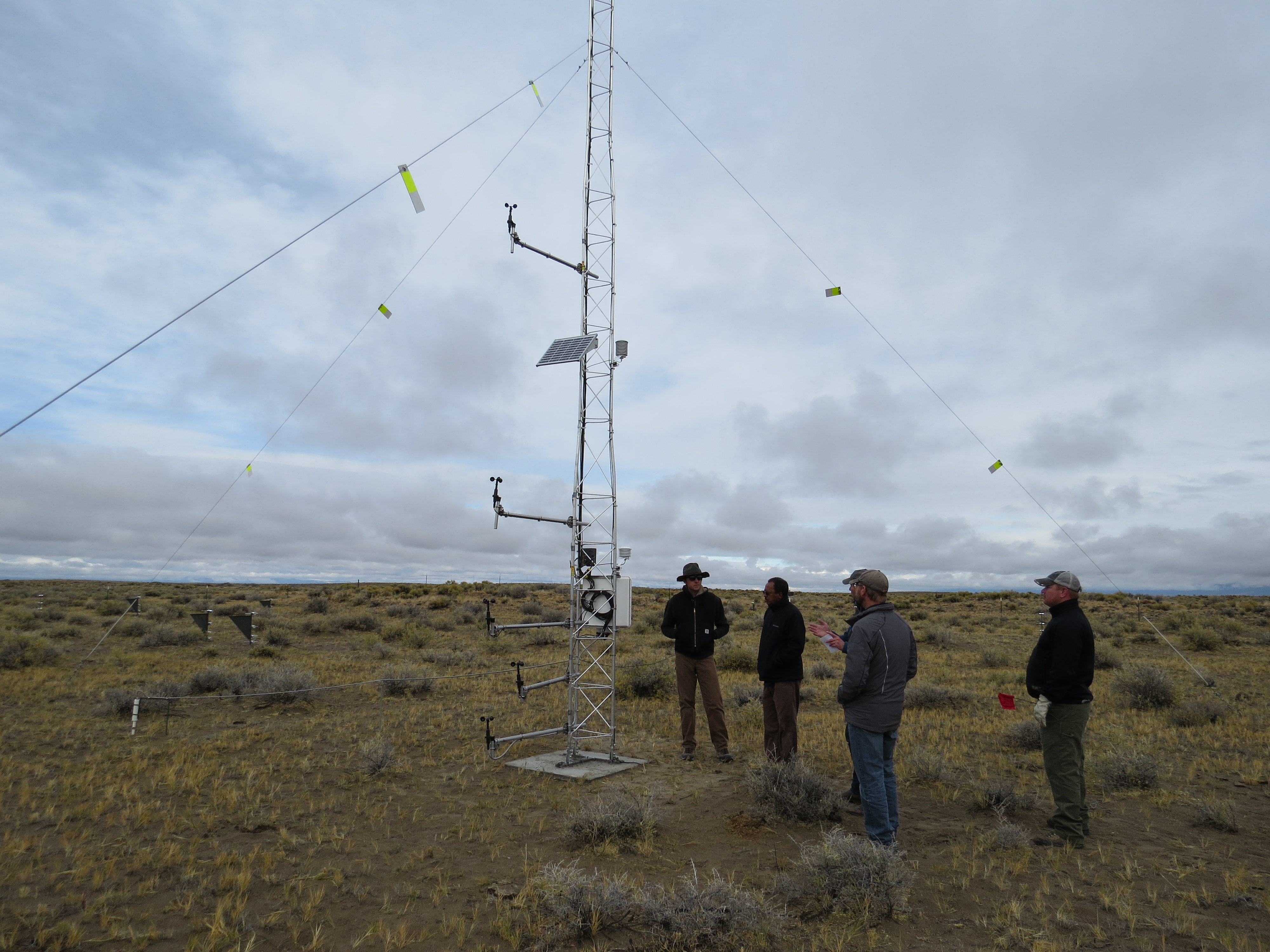
- Installed 10 Network sites across Washington, Idaho, North Dakota, Colorado, Utah, New Mexico, Texas and Oklahoma.
- Conducted training sessions at Network sites to support quality assurance (QA) and quality control (QC) in data collection, storage and management.
- Developed physically-based wind erosion model linked to national AIM and NRI datasets
Datasets Produced
Datasets that will be produced (compiled or managed) by this working group.
- Air temperature/ relative humidity
- Wind speed and direction profile
- Precipitation
- Phenology camera
- Saltation particle counts
- Horizontal sediment mass flux
- Size-resolved vertical (dust) mass flux and PM10, PM2.5, PM1 concentrations
- High-resolution soil particle size distributions
- Vegetation foliar cover by species, vegetation height, canopy gap size distribution
- Soil oriented and random roughness, physical and biological crust cover, loose erodible material and aggregate cover
Manuscripts Published
- Galloza MS, Webb NP, Bleiweiss MP, Winters C, Herrick JE, Ayers E, Exploring dust emission responses to land cover change using an ecological land classification. Aeolian Research. Submitted.
- Chappell A, Webb NP, Guerschman JP, Thomas D, Mata G, Handcock RN, Leys JF, Butler H, 2017. Improving ground cover monitoring for wind erosion assessment using MODIS BRDF parameters. Remote Sensing of Environment, Vol. 204, 756-768. doi:10.1016/j.rse.2017.09.026
- Webb NP, Marshall NA, Stringer LC, Reed MS, Chappell A, Herrick JE, 2017. Land degradation and climate change: building climate resilience in agriculture. Frontiers in Ecology and the Environment, Vol. 15, 450-459. doi:10.1002/fee.1530
- Webb NP, Van Zee JW, Karl, JW, Herrick JE, Courtright EM, Billings BJ, Boyd R, Chappell A, Duniway MC, Derner JD, Hand, JK, Kachergis E, McCord SE, Newingham BA, Pierson FB, Steiner JL, Tatarko J, Tedela NH, Toledo D, Van Pelt RS, 2017. Enhancing wind erosion monitoring and assessment for US rangelands. Rangelands, Vol. 39, 85-96. doi:10.1016/j.rala.2017.04.001
- Chappell A, Webb NP, 2016. Using albedo to reformulate wind erosion modelling, mapping and monitoring. Aeolian Research. Vol. 23, 63-78. doi:10.1016/j.aeolia.2016.09.006
- Webb NP, Herrick JE, Van Zee JW, Courtright EM, Hugenholtz CH, Zobeck TM, Okin GS, Clingan SD, Cooper BF, Billings BJ, Boyd R, Duniway MC, Derner JD, Fox FA, Havstad KM, Heilman P, Ludwig NA, Metz LJ, Nearing MA, Norfleet ML, Pierson FB, Sanderson MA, Sharratt BS, Steiner JL, Tatarko J, Tedela NH, Toledo D, Unnasch RS, Van Pelt RS, Wagner L, 2016. The National Wind Erosion Research Network: Building a standardized long-term data resource for aeolian research, modeling and land management. Aeolian Research, Vol. 22, 23-36. doi:10.1016/j.aeolia.2016.05.005
Working Group Name
Wind Erosion Working Group
Leader(s)
Nicholas Webb
Members
List will appear here

ABOUT LTAR
The USDA Agricultural Research Service (ARS) Long-Term Agroecosystem Research network consists of 18 Federal and university agricultural research sites with an average of over 50 years of history. The goal of this research network is to ensure sustained crop and livestock production and ecosystem services from agroecosystems, and to forecast and verify the effects of environmental trends, public policies, and emerging technologies.